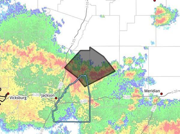
The National Weather Service in Jackson issued a severe thunderstorm warning at 2:48 p.m. CDT Saturday for parts of central Mississippi, saying the warning will remain in effect until 3:45 p.m. CDT.
At 2:48 p.m., the agency said severe thunderstorms were located along a line extending from near Sharon to near Farmhaven to near Ludlow and were moving northeast at 25 mph. Radar indicated wind gusts up to 60 mph and hail less than three-quarters of an inch.
The NWS said the storms could cause damage to roofs, siding and trees. The warning covered southwestern Leake, northeastern Rankin, northwestern Scott and northeastern Madison counties, and listed communities including Carthage, Redwater, Standing Pine, Lena, Camden, Farmhaven, Tuscola, Thomastown, Ludlow, Cameron and Sharon.
The NWS advised residents to move to an interior room on the lowest floor of a building for protection. The agency attributed the wind and hail estimates to radar indications.
This is a developing situation. We will provide more information as it becomes available.