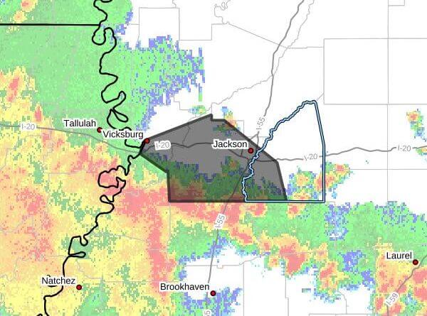
The National Weather Service in Jackson issued a severe thunderstorm warning Saturday, saying storms capable of 60 mph wind gusts and small hail were moving through parts of central and west-central Mississippi.
The warning was issued at 1:34 p.m. CDT and was in effect until 2:30 p.m. CDT, the agency said. At 1:34 p.m., the storms were located along a line extending from Yokena to near Carpenter to near Glancy and were moving northeast at 50 mph, the warning said.
The warning covered southwestern Rankin County, east central Warren County and Hinds County. Radar indicated the hail threat was less than three-quarters of an inch and wind gusts could reach 60 mph. The bulletin said residents could expect damage to roofs, siding and trees.
Locations specifically mentioned include Jackson, Clinton, Pearl, Vicksburg, Byram, Richland, Florence, Raymond, Terry, Edwards, Utica, Bolton, Bovina, Learned, Dry Grove, Brownsville, Whites, Flowers, Piney Woods and Star. The warning advised people to move to an interior room on the lowest floor of a building for protection. This is a developing story and will be updated as more details emerge.