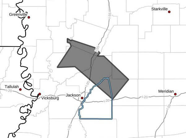
At 2:39 p.m. CDT, Doppler radar tracked a line of strong thunderstorms extending from seven miles south of Louise to near Benton and near Pisgah, moving northeast at 25 mph and expected to affect southwestern Leake, southwestern Holmes, northeastern Rankin, northwestern Scott, central Yazoo and eastern Madison counties through 3:45 p.m. CDT, the alert said.
Radar indicated wind gusts up to 50 mph as the primary hazard. The alert said gusty winds could knock down tree limbs and blow around unsecured objects, posing a risk to vehicles, homes and outdoor property.
Locations mentioned in the alert include Canton, Yazoo City, Pickens, Benton, Lena, Eden, Coxburg, Camden, Ebenezer, Leesburg, Farmhaven, Vaughan, Goshen Springs, Tolarville, Ludlow, Cameron, Sharon, Way, Thornton and Pisgah.
If outdoors, the alert advised seeking shelter inside a building. A Severe Thunderstorm Watch remains in effect until 6:00 p.m. CDT for central Mississippi. The alert listed a maximum hail size of 0.00 inches and a maximum wind gust of 50 mph.
A Severe Thunderstorm Watch means conditions are favorable for the development of dangerous storms; residents should monitor local forecasts and warnings and secure loose outdoor items. We will provide more information as it becomes available.