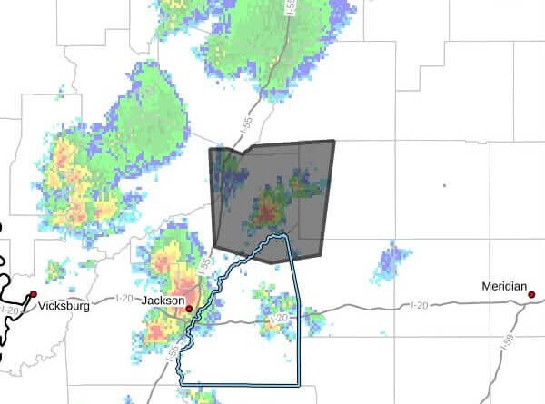
A cluster of strong thunderstorms was moving through parts of central Mississippi Saturday afternoon and was expected to affect western Leake, northeastern Rankin, southwestern Attala, northwestern Scott, east central Yazoo and northeastern Madison counties through 4:15 p.m. CDT, a Facebook post said.
At 3:09 p.m. CDT, Doppler radar was tracking the cluster near Sharon, about 12 miles northeast of Canton, moving north at 15 mph, the post said. The primary hazard listed was wind gusts up to 50 mph, with radar indicating the potential for damaging straight-line winds.
The post warned that gusty winds could knock down tree limbs and blow around unsecured objects. It said the storm would be near Cameron and Camden around 3:15 p.m. CDT. The maximum hail size reported was 0.00 inch and the maximum wind gust was 50 mph.
Strong thunderstorms can produce dangerous winds, lightning and localized downed trees or power lines. If outdoors, the post advised seeking shelter inside a building and securing loose outdoor items. We will provide more information as it becomes available.