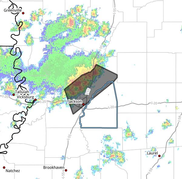
At 1:14 p.m. CDT Friday, a weather statement posted online said strong thunderstorms will impact north central Rankin, northeastern Hinds and Madison counties through 2:15 p.m. CDT.
The statement said Doppler radar was tracking a cluster of strong storms near Way, or near Canton, moving southeast at about 5 mph.
Hazards included wind gusts up to 40 mph, with radar indicating gusty conditions that could knock down tree limbs and blow around unsecured objects. The message listed a maximum hail size of 0.00 inch and a maximum wind gust of 40 mph.
The strong thunderstorm was expected to be near Canton and Sharon around 1:20 p.m. CDT. The statement advised that anyone outdoors consider seeking shelter inside a building.
Rankin, Hinds and Madison counties are in central Mississippi and can see localized damage from gusts in this range, particularly to trees and unsecured outdoor items. This is a developing story and will be updated as more details emerge.
Jon Ross Myers founded Mississippi News Group in 2013. Before founding the organization, he worked at The Daily Mississippian, The Marion Salute and The Southern Sentinel. A Mississippi journalist and writer based in Ripley, he received second place in poetry in the 2025 William Faulkner Literary Competition for "The Garden."
Stay connected
Mississippi, wherever you are.
Follow our coverage on Facebook and watch Mississippi News Group on YouTube.