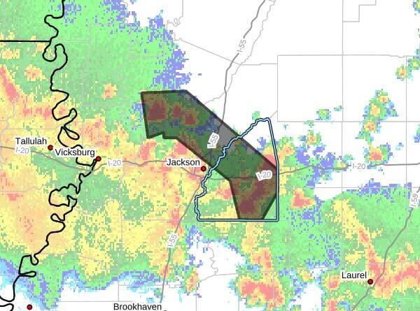
The National Weather Service in Jackson, Mississippi, issued a severe thunderstorm warning at 2:11 p.m. CDT Saturday, May 23, 2026, for parts of central Mississippi. The warning covers eastern Rankin, southwestern Yazoo, northeastern Hinds and southwestern Madison counties and remains in effect until 3:15 p.m. CDT, the agency said.
At 2:11 p.m., the NWS said severe thunderstorms were located along a line extending from near Pocahontas to near Johns and were moving north at 20 mph. Radar indicated maximum wind gusts of 60 mph and hail up to 0.75 inch. The service warned of possible damage to roofs, siding and trees.
Communities listed in the advisory include Jackson, Madison, Ridgeland, Brandon, Canton, Flowood, Gluckstadt, Flora, Pelahatchie, Bentonia, Satartia, Pocahontas, Cato, Johns, Myrleville, Annandale, Phoenix, Tinsley, Fannin and Little Yazoo.
The NWS advises residents to move to an interior room on the lowest floor of a building for protection. Severe thunderstorm warnings indicate dangerous weather is occurring or imminent. We will provide more information as it becomes available.