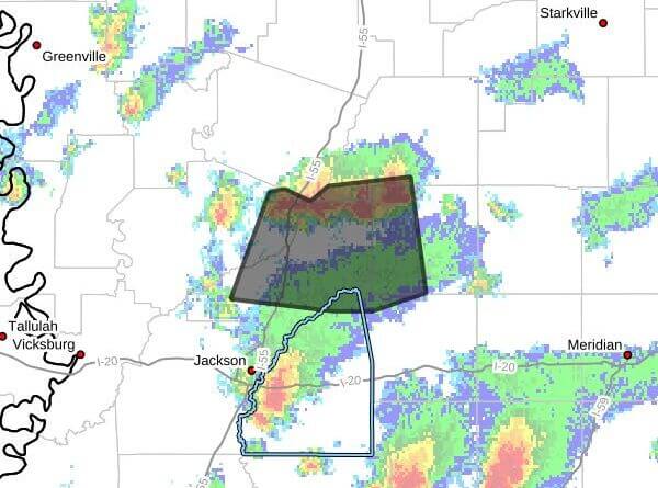
Strong thunderstorms will impact western Leake, northeastern Rankin, southwestern Attala, northwestern Scott and east-central Yazoo and Madison counties through 6:45 p.m. CDT, a Facebook post said.
At 5:45 p.m. CDT, Doppler radar was tracking a cluster of strong storms near Pickens, about 17 miles north of Canton, moving south at 20 mph, the post said. The storms were producing wind gusts up to 40 mph, which the post said could knock down tree limbs and blow around unsecured objects.
The post said the line of storms was expected near Vaughan, Way and Camden about 5:50 p.m. CDT and near Canton and Sharon about 6 p.m. CDT. The alert listed a maximum reported hail size of 0.00 inch and a maximum wind gust of 40 mph.
Officials advise people outdoors to seek shelter inside a building and to secure loose outdoor items. Severe thunderstorms can produce damaging winds, hail and dangerous lightning; motorists and residents should monitor local forecasts and be prepared to take shelter. We will provide more information as it becomes available.