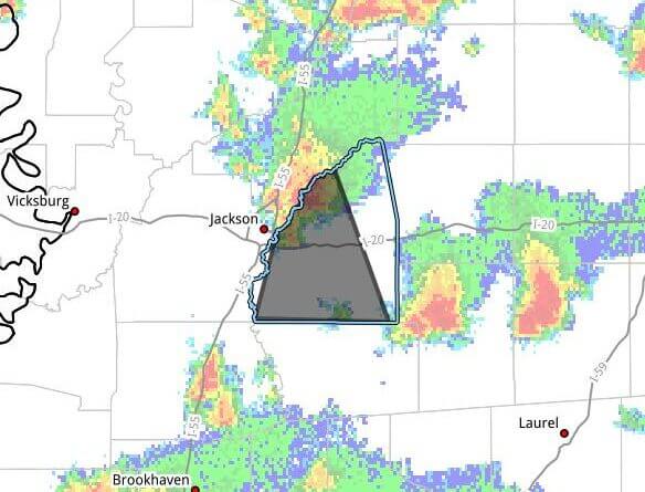
JACKSON, Mississippi — The National Weather Service in Jackson issued a severe thunderstorm warning for Rankin County until 6:15 p.m. CDT Tuesday, the agency said in a bulletin.
At 5:21 p.m., the storm was located near Brandon and moving south at 25 mph. The bulletin said radar indicated wind gusts up to 60 mph and hail as large as 1.00 inch in diameter. It warned of possible hail damage to vehicles and expected wind damage to roofs, siding and trees.
The bulletin listed expected arrival times for communities in Rankin County: Jackson, Pearl, Brandon and Flowood around 5:25 p.m.; Monterey around 5:35 p.m.; Florence around 5:45 p.m.; Star around 5:50 p.m.; and Piney Woods around 5:55 p.m.
Forecasters urged residents to move to an interior room on the lowest floor of a building for protection and to get off the water near Ross Barnett Reservoir and move indoors or inside a vehicle. The bulletin noted lightning can strike as far as 15 miles from a storm and warned that severe storms can produce large, capsizing waves on small bodies of water.
The bulletin included contact information for Haley White, assistant TAC/communications sergeant for the Rankin County Sheriff’s Office. We will provide more information as it becomes available.