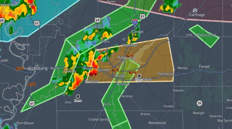
The National Weather Service in Jackson issued a severe thunderstorm warning for parts of central Mississippi at 11:43 a.m. CDT Monday, June 22, 2026. The warning covers central Rankin County, northeastern Hinds County and southwestern Madison County and is in effect until 12:45 p.m. CDT, the agency said.
At 11:42 a.m. CDT, the service said a severe thunderstorm was located over Clinton and moving east at 35 mph. Radar indicated wind gusts up to 60 mph and hail less than 0.75 inch in diameter. Officials warned of possible damage to roofs, siding and trees.
The NWS provided expected arrival times for communities in the path: Jackson, Ridgeland, Flowood and Pocahontas around 11:50 a.m.; Madison around 11:55 a.m.; Pearl around noon; Fannin about 12:05 p.m.; Brandon about 12:10 p.m.; Goshen Springs about 12:15 p.m.; Pisgah about 12:20 p.m.; and Pelahatchie and Leesburg around 12:25 p.m., the agency said. For protection, the NWS advised people to move to an interior room on the lowest floor of a building.
The National Weather Service defines a severe thunderstorm as one capable of producing winds of 58 mph or greater and/or hail of 1 inch in diameter or larger. Such storms can produce downed trees, power outages and localized property damage. This is a developing situation and will be updated as more details emerge.