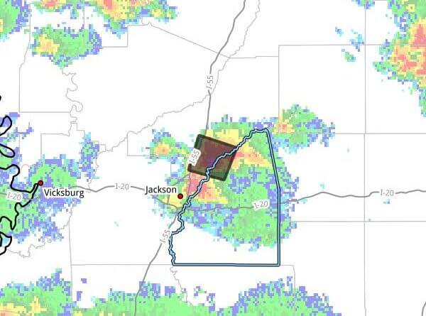
JACKSON, Miss. — The National Weather Service in Jackson issued a severe thunderstorm warning at 5:25 p.m. CDT Monday for parts of central Mississippi, including north central Rankin County and south central Madison County, the agency said.
The warning was in effect until 6:30 p.m. CDT. At 5:25 p.m., a severe thunderstorm was located near Madison and moving northwest at 5 mph, the NWS said. Radar indicated wind gusts up to 60 mph and hail up to three-quarters of an inch.
The NWS said the storm could move near Jackson, Madison, Canton and Gluckstadt about 5:30 p.m. Local officials warned residents to expect damage to roofs, siding and trees.
Officials advised people to move to an interior room on the lowest floor of a building and to get off the water near Ross Barnett Reservoir and seek shelter indoors or inside a vehicle. The bulletin noted that lightning can strike up to 15 miles from a thunderstorm and that severe storms can produce large, capsizing waves on bodies of water.
The bulletin was posted by Haley White, assistant TAC/communications sergeant for the Rankin County Sheriff’s Office, which provided contact information with the notice. This is a developing story and will be updated as more details emerge.