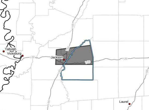
The National Weather Service in Jackson issued a severe thunderstorm warning at 11:51 a.m. CDT Monday, June 22, 2026, for parts of central Mississippi, saying the warning remains in effect until 12:45 p.m. CDT. The agency reported a storm located near Jackson moving east at 35 mph, based on radar.
Radar indicated the storm was producing wind gusts up to 60 mph and hail less than three-quarters of an inch. The NWS warned of potential damage to roofs, siding and trees.
The service listed expected arrival times for the storm: Jackson, Pearl, Madison, Ridgeland and Flowood around 11:55 a.m. CDT; Brandon and Fannin around 12:05 p.m. CDT; Goshen Springs around 12:15 p.m. CDT; Pelahatchie and Pisgah around 12:20 p.m. CDT; and Leesburg around 12:25 p.m. CDT.
The NWS advised residents to move to an interior room on the lowest floor of a building for protection. The National Weather Service issues warnings to help people take immediate action to protect life and property when severe weather is occurring or imminent. We will provide more information as it becomes available.