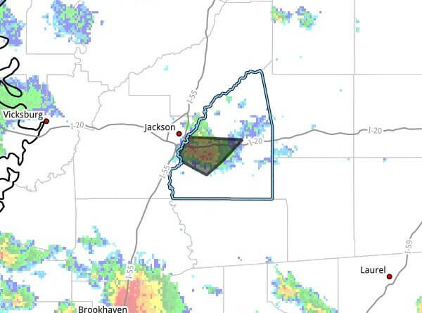
Strong thunderstorms moved across southwestern Rankin County Monday afternoon, with Doppler radar tracking a cluster near Brandon moving east at 5 mph, the bulletin said.
The warning, issued at 4:28 p.m. CDT, said wind gusts could reach 40 mph. Radar indicated gusty winds could knock down tree limbs and blow around unsecured objects. The storm was expected to be near Jackson and Brandon around 4:35 p.m. CDT.
The bulletin listed maximum hail size as 0.00 inch and identified radar as the source of the observation. It advised that people outdoors consider seeking shelter inside a building to avoid hazards from wind-driven debris.
Rankin County is in central Mississippi and includes Brandon and areas adjacent to Jackson, the state capital. Strong thunderstorms in the region can produce dangerous gusts and localized damage, and residents are urged to monitor local forecasts and take precautions. We will provide more information as it becomes available.