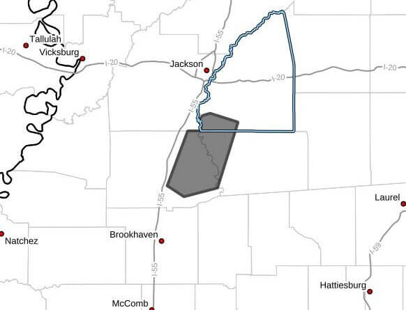
A strong thunderstorm will impact southwestern Rankin, western Simpson and eastern Copiah counties in central Mississippi through 7:00 p.m. CDT, an advisory said.
At 6:08 p.m. CDT, Doppler radar was tracking the storm near Hopewell, about 9 miles east of Crystal Springs, moving southwest at 30 mph, the advisory said. The storm was capable of producing wind gusts up to 50 mph and hail up to 0.75 inch in diameter.
The advisory listed hazards as wind gusts and penny-size hail and warned that gusty winds could knock down tree limbs and blow around unsecured objects. Minor hail damage to vegetation was possible, it said.
The storm was expected near Georgetown and Hopewell around 6:15 p.m. CDT, Hazlehurst around 6:20 p.m. CDT and Rockport around 6:30 p.m. CDT. Officials advised anyone outdoors to seek shelter inside a building. This is a developing story and will be updated as more details emerge.