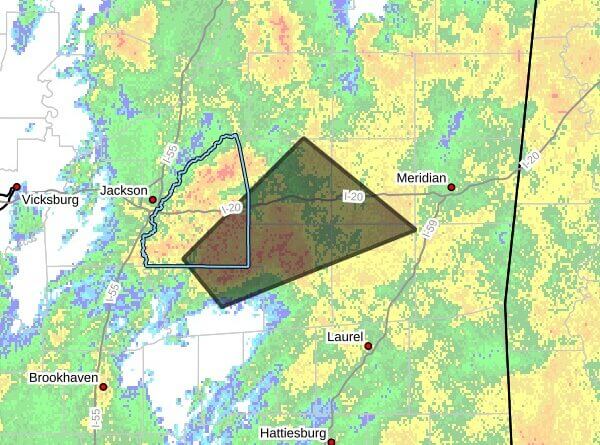
A strong thunderstorm will impact northern Jasper, southeastern Rankin, southwestern Newton, northeastern Simpson, and northern Smith and Scott counties through 9:00 AM CDT, according to a Facebook post.
At 8:23 AM CDT, the post said Doppler radar was tracking a strong thunderstorm over White Oak, about 9 miles northwest of Raleigh, moving northeast at 15 mph. The post listed the primary hazard as wind gusts up to 50 mph and gave a maximum hail size of 0.00 inches.
The post said gusty winds could knock down tree limbs and blow around unsecured objects. It forecast the storm would be near Polkville and Burns around 8:30 AM CDT and near Raleigh around 8:40 AM CDT.
Officials urged people outdoors to seek shelter inside a building. Strong straight-line winds of the magnitude reported can cause localized damage and may lead to power outages. We will provide more information as it becomes available.