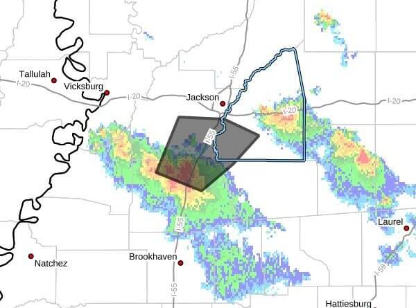
At 5:46 p.m. CDT Sunday, Doppler radar indicated a cluster of strong thunderstorms was tracking near Crystal Springs and moving northeast at 20 mph, threatening parts of southwestern Rankin, northwestern Simpson, southeastern Hinds and northeastern Copiah counties through 6:45 p.m. CDT.
The radar message said the primary hazard was wind gusts up to 40 mph. Forecasters warned those gusts could knock down tree limbs and blow around unsecured objects. Maximum reported hail size was 0.00 inch, and maximum wind gust was 40 mph.
The bulletin listed expected times of arrival for several communities: Terry and Dry Grove around 5:50 p.m.; Jackson around 5:55 p.m.; Byram around 6:00 p.m.; Whites around 6:05 p.m.; Richland around 6:20 p.m.; Florence around 6:25 p.m.; and Monterey around 6:40 p.m.
The message advised that anyone outdoors should consider seeking shelter inside a building. Strong thunderstorms can produce damaging winds and localized hazards; residents should secure loose objects and monitor local forecasts. We will provide more information as it becomes available.