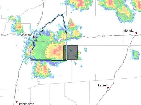
A strong thunderstorm moving east at 25 mph is expected to impact southeastern Rankin and northwestern Smith counties through 4:15 p.m. CDT Thursday, Doppler radar indicated. The storm was producing wind gusts up to 40 mph and heavy rain, the advisory said.
At 3:41 p.m. CDT, radar showed the storm near Puckett, about 13 miles northeast of Mendenhall. The advisory said the storm was expected to be near Polkville and White Oak around 3:45 p.m. CDT.
Hazards include wind gusts up to 40 mph that could knock down tree limbs and blow around unsecured objects. Torrential rainfall associated with the storm may lead to localized flooding, and the advisory urged people outdoors to seek shelter inside a building. Maximum hail size was reported as 0.00 inches.
Authorities warned motorists not to drive through flooded roadways and advised caution around older trees that may be more likely to lose large limbs. Strong summer thunderstorms are common in central Mississippi and can produce sudden high winds and heavy rain.
This is a developing situation and will be updated as more information becomes available.