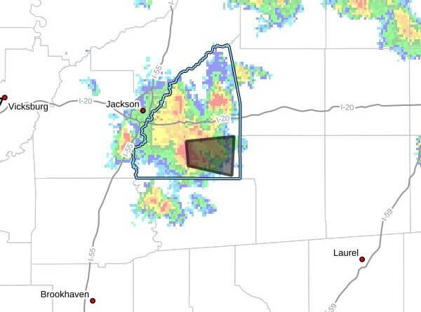
At 3:25 p.m. CDT Thursday, Doppler radar tracked a strong thunderstorm near Johns, about 10 miles southeast of Brandon, moving east at 20 mph and expected to impact southeastern Rankin County through 4 p.m. CDT.
Radar indicated wind gusts up to 40 mph and torrential rainfall with this storm. The advisory said gusty winds could knock down tree limbs and blow unsecured objects. Puckett, Johns and Cato were expected to be near the storm around 3:30 p.m. CDT.
The alert urged people outdoors to seek shelter inside a building and warned that torrential rainfall may lead to localized flooding. It advised drivers not to attempt to drive through flooded roadways. The product listed maximum hail size as 0.00 inch and maximum wind gust at 40 mph.
Rankin County is in central Mississippi, and strong thunderstorms in the region can produce sudden flooding and downed trees that cause serious injury or property damage. We will provide more information as it becomes available.