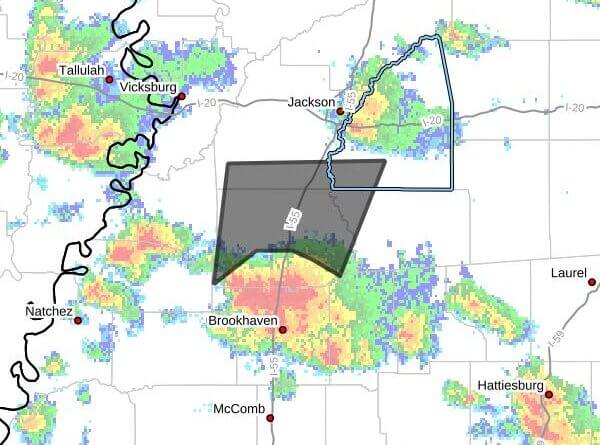
At 5:04 p.m. CDT Monday, Doppler radar tracked an outflow boundary over Hazlehurst moving northeast at about 25 mph, bringing gusty showers to Copiah, Hinds, Rankin and Simpson counties through 6:00 p.m. CDT, radar indicated.
Forecasters said wind gusts could reach up to 40 mph and could knock down tree limbs and blow around unsecured objects. The strongest thunderstorm was expected near Crystal Springs and Gallman about 5:10 p.m. CDT, near Terry about 5:25 p.m. CDT and near Whites about 5:35 p.m. CDT.
Officials advised people outdoors to seek shelter inside a building. Maximum hail size reported by radar was 0.00 inch.
An outflow boundary is a gust of cooler air that spreads out from a thunderstorm and can produce sudden, strong winds; such features can cause brief but damaging gusts even without large hail or tornadoes. This is a developing situation and will be updated as more details emerge. We will provide more information as it becomes available.