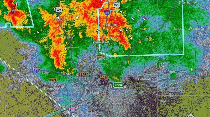
Strong thunderstorms are impacting parts of central Mississippi and bringing gusty winds, hail and heavy rain, the Rankin County Sheriff’s Office said Tuesday.
At 3:59 p.m. CDT, Doppler radar was tracking a line of strong storms extending from near Way to near Gluckstadt and moving east at 35 mph, the sheriff’s office said in a Facebook post. The warning covered southwestern Leake, northeastern Rankin, northwestern Scott and southeastern Madison counties through 4:45 p.m. CDT.
Authorities said the storms could produce wind gusts up to 40 mph and hail up to 0.50 inch. Officials warned gusty winds could knock down tree limbs and blow unsecured objects, and that minor hail damage to vegetation is possible.
The post included a timeline of expected impacts, listing Canton and Sharon about 4:05 p.m.; Goshen Springs and Pisgah about 4:10 p.m.; Farmhaven about 4:15 p.m.; and Ludlow about 4:25 p.m. It also cautioned that torrential rainfall may cause localized flooding and urged people not to drive through flooded roadways.
The sheriff’s office reminded residents that frequent cloud-to-ground lightning is occurring and can strike as far as 10 miles from a storm, and advised seeking shelter indoors or in a vehicle. A Tornado Watch remains in effect until 10 p.m. CDT for central Mississippi. This is a developing story and will be updated as more details emerge.