Mississippi news: Inland Isaias warnings expand as seven southern shelters open
Evening edition — Friday, October 9, 2026
Mississippi heads into a hazardous night and Saturday as Isaias nears the western Florida Panhandle with 110 mph winds. The hurricane’s center is farther east than Mississippi, but coastal surge warnings remain in place, inland tropical storm warnings have expanded, and emergency officials report seven shelters and safe rooms available in five southern counties.
Since this morning’s briefing, the key changes are stronger inland wind guidance, warnings reaching northeast Mississippi and a new state shelter announcement. This edition also explains updated drawbridge guidance, a Gautier missing-teen notice newly reported today and a Meridian fundraiser’s replacement date. Storm information below is tied to the cited Friday advisories, including NHC’s 7 p.m. CDT update.
Isaias nears Florida landfall; Mississippi coastal warnings remain
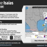
The National Hurricane Center’s 7 p.m. advisory places Isaias about 45 miles southeast of Pensacola, moving north at 18 mph. Maximum sustained winds are 110 mph, down from the 120 mph in the 10 a.m. advisory. NHC expects landfall in the western Florida Panhandle within an hour or two, followed by movement across Alabama toward the Tennessee Valley.
The lower wind speed does not cancel Mississippi’s warnings. NHC lists no warning changes: the hurricane warning begins at Ocean Springs and extends eastward, while the coast west of Ocean Springs remains in a tropical storm warning. A storm surge warning continues from the Mississippi River mouth east to Florida’s Suwannee River.
The forecast still allows 3–5 feet of water above ground somewhere between the Mississippi River mouth and Dauphin Island if peak surge coincides with high tide. That includes Mississippi’s coastline; it is a conditional forecast, not a measured water level everywhere. Follow local evacuation and emergency instructions.
NWS New Orleans’s 5:45 p.m. discussion distinguishes coastal Jackson County’s hurricane warning from tropical storm warnings for inland Jackson County and Hancock and Harrison counties. It expects lingering winds of 15–20 mph through Saturday afternoon even as conditions improve.
Eastern Mississippi faces stronger overnight wind threat
NWS Jackson’s 2:47 p.m. discussion says the existing inland tropical storm watch was upgraded to a warning, with Choctaw and Webster counties added. The change matters well beyond the Coast: stronger winds may develop west of the storm center as it moves north overnight.
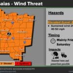
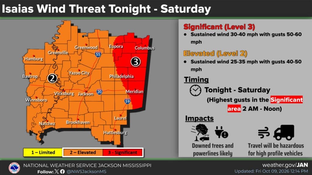
The office’s wind graphic, updated at 12:14 p.m., raises the mapped threat in parts of east and northeast Mississippi to sustained winds of 30–40 mph and gusts of 50–60 mph. Its highest-gust window in that area is 2 a.m. through noon Saturday. The remainder of the mapped region has an elevated threat of sustained winds of 25–35 mph and gusts of 40–50 mph.
This is an increase from the 40–50 mph gust range highlighted in the morning edition. The graphic identifies possible downed trees and power lines, blocked roads and hazardous travel for high-profile vehicles. Have charged devices and multiple ways to receive warnings before going to bed; avoid travel when damaging winds arrive.
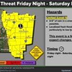
Jackson’s discussion keeps a flood watch for the Golden Triangle area, with a general 1–3-inch rain swath and a worst-case possibility of 4–5 inches in a short time. It expects much lower rainfall farther south and west. Less rain in one community does not establish that its wind threat has ended.
Four northeast counties enter tropical storm warning
NWS Memphis’s Friday afternoon forecast places Lee, Itawamba, Chickasaw and Monroe counties under a tropical storm warning, with gusts exceeding 40 mph possible. Other north Mississippi counties in its forecast area are under a Saturday wind advisory, running from 4 a.m. to 8 p.m., with gusts up to 45 mph.
The office’s 11:39 a.m. flood-watch statement retains 22 north Mississippi counties from 1 a.m. Saturday through Sunday morning. It forecasts 1–2.5 inches of rain with localized amounts up to 3 inches. A watch identifies possible flooding; respond to any subsequent warning and never drive through flooded roads.
Memphis expects the system’s rain to leave by early Sunday, with improving weather afterward. Saturday remains the principal travel and outdoor-planning concern in northern Mississippi, even for communities far from landfall.
MEMA reports seven southern shelters and safe rooms
In its October 9 release, MEMA says shelters and safe rooms are open and reports distributing 4,000 sandbags in response to county requests. Its current shelter directory lists the following locally operated sites:
- George County: 3161 Cooks Corner Road, Lucedale.
- Hancock County: 30360 Highway 603, Perkinston.
- Harrison County: 15035 County Farm Road, Gulfport.
- Central Jackson County: 5500 Ballpark Road, Vancleave.
- East Jackson County: 18413 Highway 613, Moss Point.
- Pearl River County: 124 Rodeo Street, Poplarville, and 501 Laurel Street, Picayune.
The directory schedules the Hancock, Harrison and two Jackson County shelters to close at noon Saturday. Those are planned times, subject to local changes. Confirm a site’s operation and follow local directions before traveling in deteriorating conditions. The Moss Point address above follows MEMA’s official directory and release. Our earlier shelter coverage provides background on the county-operated facilities.
New MEMA release describes conditional drawbridge operations
Friday’s MEMA release, citing MDOT, says drawbridges on I-110 and state routes 605 and 609 will remain operational as long as conditions allow. If high winds affect the area, the bridges will be locked down against marine traffic and will not be raised again until after the storm.
That differs from the earlier MDOT notice, covered in our drawbridge report and this morning’s briefing, which described gate-arm work beginning at 10 a.m. Friday and subsequent restrictions. The newer state release provides conditional operating guidance; it does not independently confirm the present position of each bridge. Boaters should verify access before relying on an opening. Neither notice announces a road closure to drivers.
Gautier police seek information about missing teenager
Gautier Police Department’s Thursday notice, newly covered on the site Friday, asks for help locating Colten Potter, 16. Police say he was last seen around noon October 7 leaving the Bayou Oaks Street area, wearing a light blue long-sleeve shirt and black shorts.
The department describes Potter as 5 feet 11 inches tall, about 230 pounds, with brown hair and hazel eyes. Anyone with information should call Gautier Police Dispatch at 228-497-2486; emergencies go to 911. Our full report links to the police announcement. These details reflect that notice, rather than a new sighting Friday evening.
Meridian fundraiser moves to November 5
A Thursday post shared by Meridian’s city government carries Mitchell Distributing’s postponement of Bud & Burgers because of expected Isaias weather. The replacement date is Thursday, November 5, from 5–8 p.m. on the Meridian City Hall Lawn.
The organizers say ticket holders who cannot attend the new date may request a refund. The event benefits Love’s Kitchen in downtown Meridian. This is newly covered in this edition, although the announcement was made Thursday. Read our Meridian postponement report before making plans around the former date.
Compiled with AI assistance from Mississippi News Group coverage and linked official sources. See our editorial standards and AI disclosure.