Mississippi news: Isaias warnings give way to wind advisories; shelter rides offered
Morning edition — Saturday, October 10, 2026
Mississippi’s storm concerns have changed overnight: Isaias has weakened inland, tropical storm warnings have given way to wind advisories, and the northern flood-watch area has narrowed. Strong gusts and heavy rain still threaten parts of the state Saturday, while the Coast remains under a coastal flood advisory.
New practical developments include an Uber shelter-ride promotion announced by Mississippi emergency officials, the postponement of today’s Family Fun Day in Tupelo and MDOT travel restrictions. Compared with Friday evening’s briefing, this edition updates the warning changes, remaining hazards and weekend plans using Saturday morning NWS products.
Wind advisories replace inland tropical storm warnings
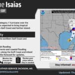
In its October 10 discussion, updated at 7:17 a.m. CDT, NWS Jackson says Isaias made landfall near Destin Friday evening and weakened to a post-tropical cyclone while moving north. Its local tropical storm warning was canceled and a wind advisory added in those areas. That change describes the storm’s evolution; damaging gusts remain possible well west of its center.
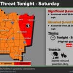
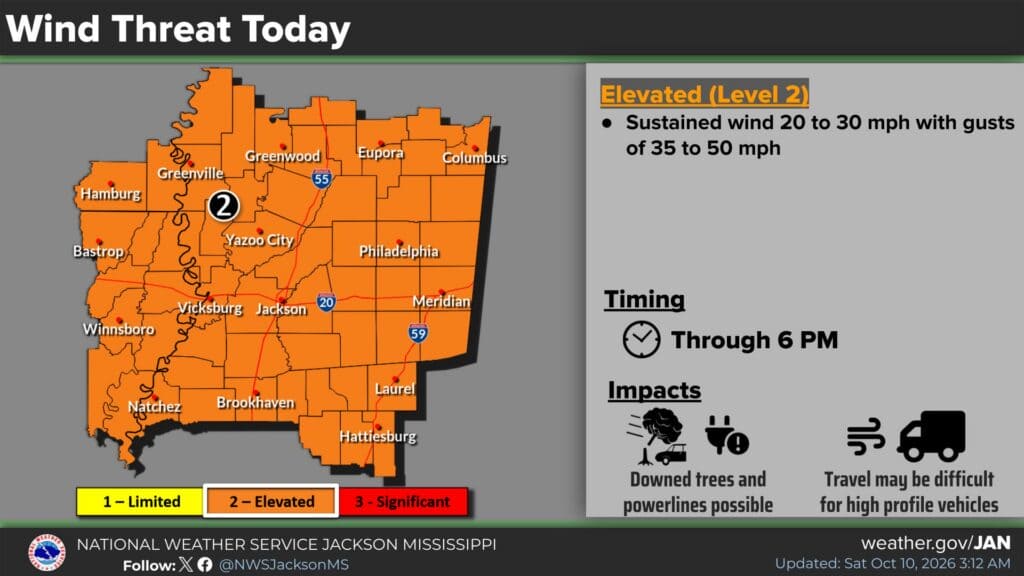
The office expects gusts of 40–50 mph from the Golden Triangle into central Mississippi by midmorning, with gusts above 30 mph possible elsewhere in its forecast area by midday. The current wind graphic shows sustained winds of 20–30 mph and gusts of 35–50 mph in the mapped elevated-threat area through 6 p.m. The formal wind advisory runs until 7 p.m. CDT.
Forecasters identify possible downed trees and power lines, blocked roads and localized outages, especially in eastern and northeastern Mississippi. High-profile vehicles may be difficult to control. Secure loose outdoor items, keep devices charged and stay away from downed lines. A lighter rainfall forecast in western communities does not remove their wind concern.
Northern flood watch narrows to 15 Mississippi counties
NWS Memphis’s 6:34 a.m. update lists a wind advisory across its Mid-South forecast area through 8 p.m. Saturday, with gusts up to 45 mph in its current key messages. Its alert list now places Lee, Itawamba, Chickasaw and Monroe counties under that advisory, replacing the tropical storm warning highlighted Friday evening. Our overnight Mid-South report provides background on the earlier warning.
The latest Memphis flood-watch statement, issued at 10:36 p.m. Friday and valid through 7 a.m. Sunday, covers 15 Mississippi counties: Alcorn, Benton, Calhoun, Chickasaw, Itawamba, Lafayette, Lee, Marshall, Monroe, Pontotoc, Prentiss, Tippah, Tishomingo, Union and Yalobusha. Friday evening’s edition reported 22 counties; the office subsequently removed some western counties as rain estimates declined.
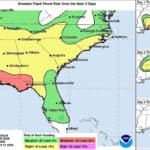
The statement forecasts 1–3 inches, with the heaviest rain favored in northeastern Mississippi. Excess runoff could affect creeks, streams and low-lying areas. A watch means flooding is possible, so monitor later warnings and avoid water-covered roads. Our Lafayette County report includes local travel and preparedness guidance.
Coastal hurricane warnings end; flooding advisory continues
NWS New Orleans’s 5:20 a.m. discussion says hurricane, tropical storm and storm surge warnings in its area have been canceled. This is a material change from Friday evening, when Mississippi coastal warnings remained in place as Isaias approached Florida.
A coastal flood advisory remains valid until 7 p.m. Saturday for southern Hancock, southern Harrison and southern Jackson counties. The formal statement warns of minor flooding of lots, parks and roads, with isolated road closures possible. Do not drive around barricades or through water of unknown depth.
The office expects decreasing clouds and improving conditions, but its marine discussion cautions that seas may take into the afternoon to settle. Improving forecasts do not establish that every road, waterway or facility has reopened. Check local instructions before traveling or resuming boating.
Hattiesburg detour planned; Coast drawbridges closed to boats
MDOT’s U.S. 98 notice, updated October 5 and listed on its news index October 9, schedules closure of both directions over I-59 in Hattiesburg from 7 p.m. Friday, October 9, until 4 a.m. Monday, October 12, for structural maintenance. The published schedule therefore spans this weekend; it does not describe a new closure beginning tonight.
Westbound traffic is to use I-59 north to U.S. 49 at Exit 67B, then return south on I-59 to U.S. 98. Eastbound traffic is to use I-59 south to U.S. 11 at Exit 60 and return north. Follow posted detour signs and allow extra time. The announcement establishes the plan, rather than independently confirming work-zone conditions this morning.
On the Coast, MDOT’s Friday 12:09 p.m. update confirms that rising winds prompted closure of drawbridges on I-110 and state routes 605 and 609 to marine traffic. It says they were locked down and would not be raised until after the storm passed. This direct update adds confirmed closure information to the conditional guidance in Friday evening’s briefing; it is a Friday announcement, not a newly observed Saturday closure.
The release does not announce closure of those roads to motorists or confirm that bridge openings have resumed. Boaters should verify present access, and drivers can check MDOT’s live travel information for current restrictions.
Shelter rides offer up to $40 each way
In a Friday announcement newly reported overnight, MEMA says Uber is offering rides to and from open, state-approved evacuation shelters. The promotion allows two trips per account, with a maximum discount of $40 per trip. Our full shelter transportation report explains the offer.
Before requesting a trip, open the Uber app, choose Account, then Wallet, select the option to add a promo code and enter ISAIAS26. The code must be applied before the intended ride, and the trip must be requested through the app. The offer is nontransferable and subject to change or cancellation; the $40 cap should not be read as an unlimited free fare.
Use MEMA’s shelter directory and confirm local operations before requesting a ride. At this morning’s check, it lists the Agricola shelter in George County, Necaise in Hancock County and County Farm Road in Harrison County. The Hancock and Harrison entries schedule noon Saturday closures. The directory reports local openings; yesterday’s longer list should not be assumed current.
Tupelo postpones today’s Family Fun Day
A Downtown Tupelo announcement shared by the mayor’s office Friday postpones Family Fun Day at The Depot, which had been scheduled for October 10, because of forecast storm conditions and strong winds. Organizers have not supplied a replacement date in that announcement and ask residents to watch their social channels for updates.
The same notice keeps Tupelo Chili Fest on the calendar for Friday, October 16, at Fairpark as part of Fall Into Tupelo 2026. That is a separate event, not the replacement date for Family Fun Day. Read our Tupelo event report before heading to The Depot today.
Drier Sunday follows a day of uneven hazards
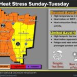
Jackson forecasters retain a northeastern Mississippi flood watch through 7 p.m. Saturday, with 1–3 inches possible in a short period. Farther southwest, some communities may receive little rain. The office also flags increased fire-weather danger in its southeastern area today as humidity falls and winds remain strong: a tropical system nearby does not guarantee wet conditions everywhere.
Jackson and Memphis expect rain to depart by Saturday evening or early Sunday, followed by drier, warmer weather. Jackson’s preliminary Sunday highs include 91 degrees in Jackson and Hattiesburg, 88 in Meridian and 93 in Vicksburg. Use the improving outlook for planning, while checking for updated alerts and local access information before setting out.
Compiled with AI assistance from Mississippi News Group coverage and linked official sources. See our editorial standards and AI disclosure.