Mississippi news: Flood watch expands inland as Rankin rail incident emerges
Evening edition — Saturday, October 3, 2026
Mississippi’s flood concern widened Saturday afternoon as the National Weather Service added three inland counties to a watch already covering the Coast. In Rankin County, deputies reported an SUV blocking railroad tracks and an approaching freight train stopping nearby. Sunday travelers face wet weather and a planned early-morning I-55 closure in Jackson, while health officials and Northeast Mississippi Community College have practical information for the coming week.
Flood watch expands to Pike, Walthall and Pearl River counties
The NWS New Orleans/Baton Rouge watch issued at 4:40 p.m. adds Pike, Walthall and Pearl River counties through Sunday evening. Northern and southern Hancock, Harrison and Jackson counties remain covered. That inland expansion is the principal change since today’s morning briefing, which described the three coastal counties.
The newly added counties face several rounds of showers and thunderstorms, with a broad forecast of 3–5 inches and locally higher amounts of 6–8 inches through Sunday evening. The coastal portion of the watch retains a separate forecast of 4–7 inches, with isolated totals of 8–10 inches. These are forecast amounts, not a report that each community has already received that much rain.
NWS’s 4:47 p.m. update says radar trends and rain already received prompted the westward expansion toward Interstate 55. Excess runoff can affect creeks, rivers, poorly drained streets and other low places. People in flood-prone locations should monitor subsequent warnings and be ready to act if flooding develops. The watch runs until midnight at the end of Sunday, October 4.
A separate 2:47 p.m. coastal flood advisory forecasts water 1–2 feet above normally dry ground during high tide in southern Hancock, Harrison and Jackson counties from midnight tonight to 8 a.m. Sunday. It concerns tidal flooding, alongside the rainfall threat. Follow barricades, allow extra travel time and avoid water of unknown depth.
Rankin sheriff reports train stopped short of SUV on tracks
The Rankin County Sheriff’s Office’s Saturday statement says dispatchers contacted the railroad after witnesses reported an SUV stopped on tracks near the Airgas facility in the Star community. An approaching freight train stopped about 200 yards from the vehicle, according to the sheriff’s account.
At approximately 9:30 a.m., callers had reported the red Chevrolet SUV traveling south in the northbound lanes of U.S. Highway 49. The statement says the driver subsequently went onto Dixie Road and then the railway. After leaving the SUV, he allegedly attempted to take a passing motorist’s vehicle. The motorist held him at gunpoint until deputies arrived, the agency said.
Deputies identified the detained man as Ronnie Percy Holmes, 22, of Florida. The sheriff’s office says he was evaluated at the University of Mississippi Medical Center before being booked into the county jail, and is expected to appear before County Court Judge David Morrow on attempted-carjacking and railway-obstruction charges. Those are allegations; the statement does not report a conviction or a completed court appearance.
The agency says the Mississippi Office of Homeland Security and the FBI’s Jackson office were notified. Our full Rankin County report provides the incident sequence.
Evening forecasts adjust inland rain chances and flag low clouds
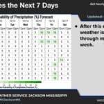
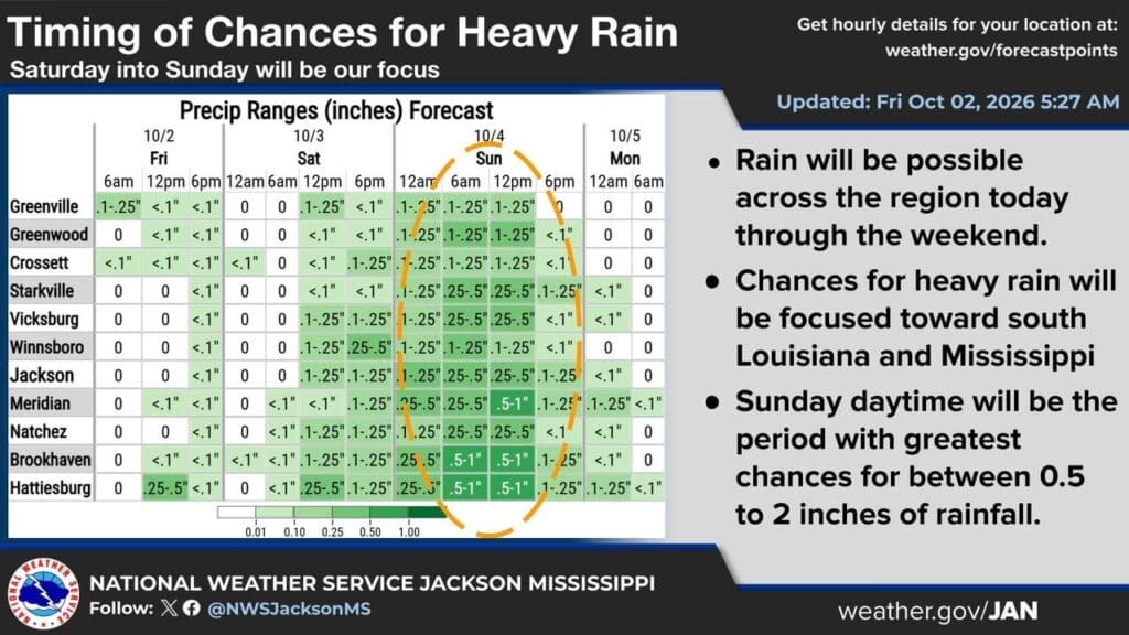
The 6:49 p.m. NWS Jackson discussion keeps Sunday rain chances high but changes some details from the afternoon figures in the morning edition. Hattiesburg’s Sunday daytime chance is now 70%, down from 90%; Jackson and Meridian remain at 80%. Forecast Sunday highs are 80 in Hattiesburg, 81 in Jackson and 79 in Meridian. Jackson’s Sunday-night rain chance is 40% in the evening table, compared with 10% earlier.
The new aviation discussion anticipates low clouds across much of the region overnight, with patchy fog and showers capable of reducing visibility. Improvement Sunday may be slow, with Greenville and Greenwood potentially improving first as drier air moves in. For road travelers, the practical issue is changing visibility as well as wet pavement; an aviation forecast is not a road-closure notice.
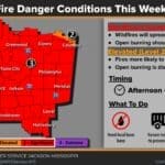
In north Mississippi, NWS Memphis’s 5:37 p.m. update retains showers through Sunday and the possibility of an isolated thunderstorm. A reinforcing front late Sunday should bring drier weather and early-week highs around the mid-70s to lower 80s. Its fire-weather discussion now highlights a medium-to-high probability of humidity below 30% Wednesday and Thursday. That is an outlook for drying conditions, not a new burn ban.
Sunday reminder: Jackson I-55 closure begins at 7:45 a.m.
The former Department of Public Safety administration tower demolition remains scheduled for Sunday, October 4. This is a next-day reminder of the plan reported earlier, rather than a newly announced closure. Saturday’s DPS coverage gives the planned I-55 window as 7:45–8:15 a.m., with officials urging remote viewing through an MDOT Traffic camera.
The governor’s October 1 road notice identifies southbound I-55 at Lakeland Drive and northbound I-55 at Fortification Street, plus restrictions near Woodrow Wilson Avenue, the VA hospital and the museum area. Allow extra time and check MDOT Traffic before leaving. The roughly 30-minute estimate is a work plan, not a guarantee of reopening at a precise minute.
MSDH points patients to MyChart tools
In a Saturday MyChart notice, the Mississippi State Department of Health reminds patients that the portal can track appointments, show test results, handle eligible prescription-refill requests and send secure, non-urgent messages to a care team.
The announcement promotes an existing service; it does not announce a new statewide launch or promise that every prescription is eligible. Patients can reach the state’s portal through MSDH’s MyChart link, which redirects to its login page. The non-urgent designation matters when planning a question or request for the coming week: the agency presents messaging as a care-management tool, not an emergency-response channel.
Northeast students face Monday deadline as fall break begins
Northeast Mississippi Community College’s 2026–27 academic calendar lists fall break October 5–9. Its non-instructional employee holiday schedule lists work resuming October 12. Students arranging an office visit next week should account for that published break.
The separate eLearning calendar lists Monday, October 5, as the end of the Short Term I withdrawal period, with finals October 12–15. Those online-course dates should not be confused with the general campus break. Students considering withdrawal should contact the eLearning office or their adviser to confirm the procedure and consequences for their own enrollment.
For students planning the next session, online Short Term II begins October 19, with the last drop/add day October 20. The eLearning coordinator’s listed number is 662-720-7193. These are published calendar milestones for the coming weeks, not a new college announcement issued tonight.
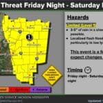
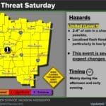
Featured graphic: NWS Jackson’s October 2, 2026, 5:27 a.m. inland rain-timing forecast. Saturday evening updates and the separate southern Mississippi flood watch are explained above. Credit: US National Weather Service Jackson Mississippi.
Compiled with AI assistance from Mississippi News Group coverage and linked official sources. See our editorial standards.