Mississippi news: Isaias prompts coastal watches as inland flood threat shifts east
Morning edition — Wednesday, October 7, 2026
Weather updated early Wednesday afternoon before publication.
Hurricane and storm-surge watches now cover parts of the Mississippi Coast as Tropical Storm Isaias strengthens in the southwestern Gulf. A new early-afternoon statement expands hurricane watches into northern Harrison and northern Jackson counties, while inland forecasters identify weekend rain and wind concerns farther north.
Today’s briefing also covers Southaven’s resolved missing-person appeal, two separate Tunica shooting investigations, Lauderdale County road work and a new statewide breast-screening reminder. The forecasts below are regional and time-specific; conditions and later advisories can change.
Hurricane watches expand inland in Harrison and Jackson counties
The National Weather Service’s 1:03 p.m. Wednesday local statement places northern and southern Harrison and Jackson counties under hurricane watches. Southern Harrison and southern Jackson also have storm-surge watches. Southern Hancock is under tropical-storm and storm-surge watches.
The statement lists Isaias as a tropical storm with 50-mph winds, about 600 miles south-southwest of Gulfport. NWS forecasts coastal impacts most likely Friday into Saturday, with potential surge of 3–5 feet from Bay St. Louis westward and 5–7 feet eastward. Those are forecast hazards, not observed water levels. A watch signals possible conditions and time to prepare; it is not a report that hurricane conditions are already occurring.
Residents should review emergency plans, secure property before conditions deteriorate and follow local officials’ evacuation advice. Hazards can extend away from the center’s eventual track. MEMA’s Isaias resource page provides state updates as preparations develop.
Inland flash-flood outlook shifts toward central and eastern Mississippi
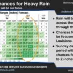
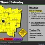
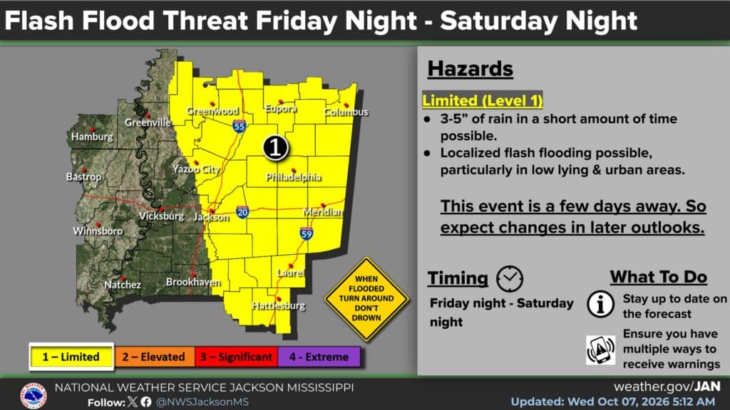
NWS Jackson’s 5:12 a.m. Wednesday graphic now identifies a limited, Level 1 flash-flood threat from Friday night through Saturday night, October 9–10. It shows the possibility of 3–5 inches of rain in a short period, with localized flooding especially in low-lying and urban areas.
The shaded area focuses on central and eastern parts of the Jackson forecast region, including Jackson, Meridian, Laurel and Hattiesburg. Western locations such as Vicksburg and Natchez fall outside the highlighted area in this graphic. This is a forecast boundary that may change, rather than a guarantee of no impacts elsewhere.
That is a meaningful change from Tuesday morning’s briefing, which described a Saturday outlook of 2–4 inches across the office’s broader region. The Jackson discussion places possible inland rain and wind impacts from Friday night through Saturday night. The graphic remains an advance outlook, not an active flash-flood warning.
Mississippi Sound moves from boating advisory to hurricane watch
The 10:21 a.m. New Orleans/Baton Rouge marine message replaces the small-craft advisory with a hurricane watch for Mississippi Sound and other listed sounds and open Gulf waters east of the Mississippi River. Tropical-storm-force winds are possible from Friday morning until early Saturday morning.
The message lists northeast winds of 30–40 knots with gusts to 60 knots and seas of 19–24 feet across that group of marine zones. These are regional forecast conditions; the sea heights should not be applied uniformly to sheltered shorelines. Small-craft conditions continue ahead of the stronger storm threat.
NWS advises mariners to remain in port, alter course or secure vessels for extreme conditions before the weather worsens. Today’s comparatively quiet weather on land should be used for preparations rather than treated as evidence that the approaching coastal hazard has passed.
North Mississippi stays hot before Saturday’s rain and gusts
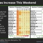
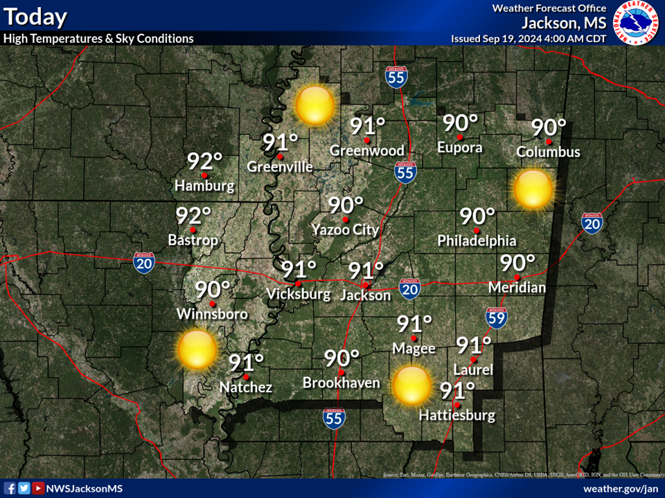
The Memphis office’s 12:17 p.m. discussion expects the Mid-South to remain dry through Friday, with highs in the upper 80s and lower 90s Thursday and Friday. Afternoon humidity of about 25–35% warrants attention to local burning restrictions.
Isaias’s remnants could bring the greatest regional impacts during Saturday and late Saturday evening. The office identifies gusts of 20–30 mph and 1–3 inches of rain as the main concerns, most pronounced east of the Mississippi River, including northeast Mississippi and the Tennessee River area.
The western extent remains uncertain, and some northeastern Mississippi locations could receive higher rainfall totals. Forecasters expect rain to move out sometime Sunday. Check later forecasts before weekend travel or outdoor work, and keep the northern outlook separate from the more serious coastal watches.
Southaven police close missing-person appeal with safe-location update
Southaven police said Shana Warren and her 11-month-old son, Jacob, were safely located. The department’s original notice timestamps that update at 4:45 p.m. Tuesday, October 6; our report appeared Wednesday morning.
The important change is that the search appeal has been resolved. Police thanked the public for assisting. The update supplies no further circumstances, so this briefing does not infer how or where they were found. Readers encountering an older missing-person image should refer to the updated official notice.
Tunica reports arrests and seeks help in a separate shooting
The Tunica County Sheriff’s Office says deputies executed warrants Monday, October 5, in the September 30 Sears Avenue shooting. According to its original release, Milton Smith, 19, Lamarion Smith, 18, and Quindarrius Gates, 18, all of Tunica, each face five attempted-murder counts, one count of shooting into a dwelling and one unlawful-firearm-discharge count. These are allegations, not convictions.
Deputies reported collecting more than 50 spent shell casings at the shooting scene and three firearms while serving warrants. The original incident injured one person, whom authorities described as grazed by a bullet. Our full arrest report was published Tuesday evening.
A separate sheriff’s appeal concerns shots fired into two residences near Edwards Avenue and Freemont Street at about 4:12 a.m. Saturday, October 3. Deputies said they collected more than 90 casings and seek identification of two people shown in video. The office offers a $1,000 reward per suspect for identifying information. Call CrimeStoppers at 662-910-0400; our separate report explains that investigation.
Lauderdale road closure is scheduled during today’s workday
Lauderdale County Road and Bridge’s notice shared by the sheriff’s office schedules the 2000 block of Old 8th Street Road for closure Wednesday from 8 a.m. to 3 p.m. Crews plan to replace a cross pipe between Sneed Road and West Adams Road.
Drivers should avoid the work area where possible and allow for delays. The county asks motorists to slow down and watch for crews and equipment. The posted hours are the planned work window; they do not independently confirm the road’s current status or guarantee reopening exactly at 3 p.m. Call the Road and Bridge Department at 601-482-9798 with questions. See our full road report.
New screening reminder includes a provider-referral number
In its October 6 breast-cancer release, the Mississippi State Department of Health urges regular screening and reports roughly 400 breast-cancer deaths and more than 2,300 new diagnoses annually statewide. Those are the agency’s annual estimates, not a count announced for this week.
MSDH says screening is intended for women without symptoms and that a mammogram can identify cancer before symptoms develop. Changes such as a lump, nipple discharge or skin changes should be reported to a health-care provider rather than held until the next routine screening. Personal and family history can help a provider assess whether earlier or additional screening is needed.
Registration for MSDH’s October 22 screening event is already closed. Women seeking help connecting with a provider can still call the Breast and Cervical Cancer Program at 601-576-7466. That referral option remains useful even though the event is no longer accepting registrations.
Featured graphic: National Weather Service Jackson flash-flood outlook, updated October 7, 2026, at 5:12 a.m. Credit: National Weather Service Jackson. This regional advance outlook may change and is not an active flood warning. Unaltered federal NWS material is public domain.
Compiled with AI assistance from Mississippi News Group coverage and linked official sources. See our editorial standards.