Mississippi news: Isaias reaches 100 mph as inland watches expand
Evening edition — Thursday, October 8, 2026
Hurricane Isaias has strengthened to 100 mph, and Mississippi’s inland storm preparations now include tropical-storm and flood watches issued after this morning’s briefing. Coastal warnings remain in place as forecasters expect conditions to deteriorate Friday.
Tonight’s Mississippi news briefing also covers Friday health-department closures, the final guilty plea in a Tupelo triple-killing case newly reported on the site, and state shooting facilities available ahead of deer season. The key weather changes since the morning edition are stronger winds, inland watches and a more specific weekend timetable.
Isaias reaches 100 mph; coastal preparations become urgent
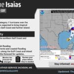
The National Hurricane Center’s 7 p.m. CDT advisory places Isaias about 290 miles south of the mouth of the Mississippi River, moving northeast at 13 mph. Its maximum sustained winds are 100 mph, with additional strengthening expected through early Friday. The NWS New Orleans/Baton Rouge office identifies the storm as Category 2, up from the Category 1 overview available this morning.
NHC expects a turn north Friday and landfall within the warning area late Friday or early Saturday. Its hurricane warning extends from Ocean Springs east to Florida’s Bay/Gulf county line. A tropical-storm warning covers the coast west of Ocean Springs toward Louisiana’s Jefferson/Plaquemines parish line. These coastal warnings were already in place this morning; the change tonight is the storm’s strength and advancing arrival time.
The advisory forecasts possible surge of 5–7 feet above ground somewhere between Ocean Springs and Indian Pass, Florida, and 3–5 feet between the mouth of the Mississippi River and Ocean Springs if peak surge coincides with high tide. Those are location-dependent ranges, not a uniform depth along the entire coast. Residents should follow local evacuation instructions and finish protective work before hazardous winds arrive.
Ten inland counties receive tropical-storm watches
In its 5:07 p.m. discussion, NWS Jackson says it added a tropical-storm watch for Forrest, Jones, Jasper, Newton, Neshoba, Winston, Noxubee, Kemper, Lauderdale and Clarke counties through Saturday evening. A watch signals that tropical-storm conditions are possible; it is not a report that those winds have begun.
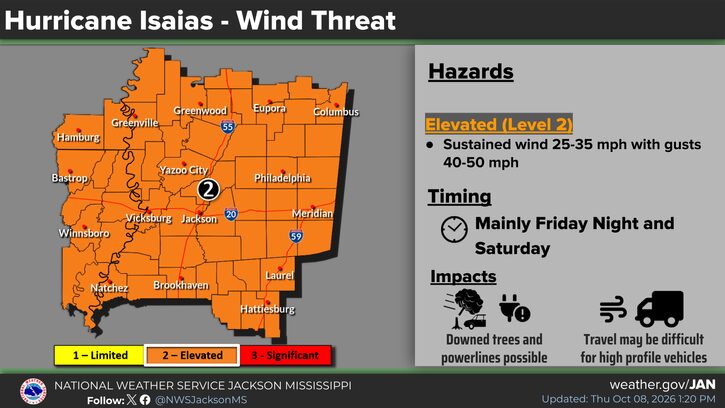
The office now describes potential gusts of 40–50 mph, compared with the 30–40 mph range in the morning briefing. It highlights the Interstate 59–U.S. 45 corridor and says stronger gusts could extend farther west into the Jackson metro and Delta. The forecast center track remains east of the area, but that does not remove Mississippi’s exposure to wind.
The agency’s updated wind graphic lists possible downed trees and power lines and difficult travel for high-profile vehicles, mainly Friday night and Saturday. Secure loose outdoor items while conditions permit, charge essential devices and plan for possible outages. The office also continues to flag fire danger in northern and western areas Friday; expected rain does not cancel a local burn ban.
Flood watches add a weekend action window
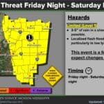
Official flood-watch statements issued Thursday cover different parts of Mississippi on different schedules. NWS Jackson’s watch runs Friday evening through Saturday evening in Grenada, Carroll, Montgomery, Webster, Clay, Lowndes, Choctaw, Oktibbeha, Winston, Noxubee, Kemper, Lauderdale and Clarke counties.
NWS Memphis’s watch covers 22 north Mississippi counties, including DeSoto, Lafayette, Lee, Alcorn, Tippah, Tishomingo, Union, Monroe and nearby communities, from late Friday night through Sunday morning. The watches concern possible excessive runoff and flooding in streams, low-lying areas and places with poor drainage. They do not establish that flooding is occurring tonight.
The Memphis evening forecast raises the northern gust estimate to 40 mph, from 35 mph this morning, and generally expects 1–3 inches of rain with locally higher amounts up to 4 inches. It says rain should exit early Sunday. A possible wind advisory is discussed for a later forecast package; the discussion does not announce one.
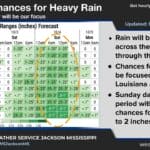
Jackson’s afternoon forecast retains a 2–4-inch rain estimate in north-central, northeastern and eastern areas, with 1–3 inches elsewhere in its region. Monitor subsequent warnings, have an alternate route around flood-prone roads and avoid driving through floodwater. Dry ground and drought do not prevent dangerous runoff from intense rain.
George and Jackson health departments close Friday
MSDH’s severe-weather closure notice for October 9 lists the George County and Jackson County health departments as closed Friday. The agency says county health departments and WIC centers in some coastal areas will close because of severe weather.
Anyone with a visit planned at those offices should check with MSDH about rescheduling before traveling. Its statewide appointment number is 855-767-0170. The notice names those two county departments; readers should check their own location for subsequent changes as the storm approaches.
Final defendant pleads guilty in Tupelo killings
Mississippi News Group’s new Thursday report on Jaylen Wells concerns a plea entered October 6, rather than a new Thursday court proceeding. The First Circuit District Attorney’s Office says Wells, 22, pleaded guilty to three manslaughter charges in the deaths of Norahs Coleman, Jessica Pannell and Robben Wilson.
The prosecutor’s release shared by Tupelo police says the victims were killed at a July 24, 2021, social gathering on Maynard Drive. Judge Kelly Mims imposed 31 years in Mississippi Department of Corrections custody, with an additional 29 years suspended. Wells had been set for an October 26 trial in Lee County.
Prosecutors describe Wells as the fourth and final defendant to plead guilty. They say law enforcement and the victims’ families approved the agreement. The plea resolves his scheduled trial through an admitted offense; the custody term and suspended term are separate parts of the sentence.
MDWFP points hunters to three preparation facilities
In a Thursday report newly added to the site, the Mississippi Department of Wildlife, Fisheries and Parks encourages hunters to sight in firearms ahead of November 21. Its announcement names McIvor Shooting Facility in Sardis, Turcotte in Canton and McHenry in Perkinston.
The agency’s facility directory confirms rifle and pistol ranges at all three, alongside other shooting and archery offerings. Follow each facility’s own information for operating hours, services and requirements before arranging a visit. With storm impacts expected Friday into the weekend, a season-preparation reminder should not be treated as assurance that a facility will operate normally during severe weather.
Compiled with AI assistance from Mississippi News Group coverage and linked official sources. See our editorial standards and AI disclosure.