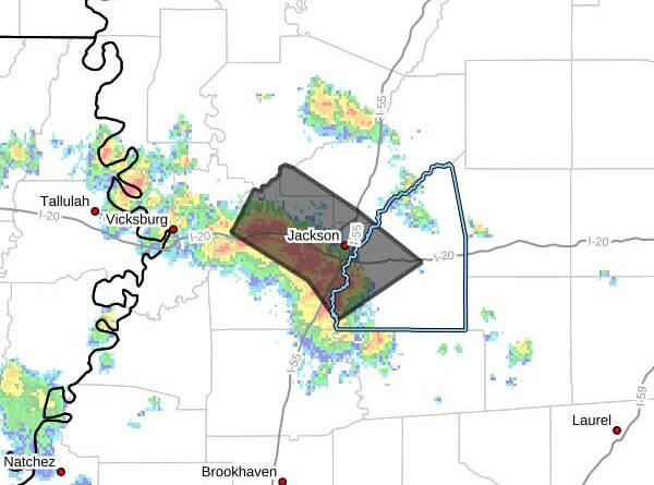
Strong thunderstorms will impact parts of the Jackson metropolitan area through 11:45 a.m. CDT Sunday, a weather statement posted at 11:05 a.m. CDT said.
Doppler radar indicated a line of strong storms extending from near Bolton to near Clinton to near Florence, moving northeast at about 20 mph with maximum wind gusts of 40 mph. The statement warned gusty winds could knock down tree limbs and blow around unsecured objects.
The storms were expected near Jackson, Clinton, Richland, Brownsville and Monterey around 11:10 a.m.; near Pearl about 11:15 a.m.; Flowood about 11:20 a.m.; and Brandon and Pocahontas about 11:25 a.m. The notice also listed a maximum hail size of 0.00 inch and reiterated the 40 mph wind gusts.
Officials urged people outdoors to seek shelter, avoid flooded roadways and get out of the water on or near Ross Barnett Reservoir and move indoors or into a vehicle. The statement noted torrential rainfall may cause localized flooding and reminded the public that lightning can strike as far as 10 miles from a thunderstorm. We will provide more information as it becomes available.