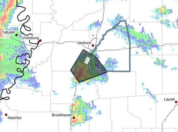
Strong thunderstorms will impact southwestern Rankin, northwestern Simpson, southeastern Hinds and northeastern Copiah counties through 9:30 p.m. CDT, the alert said.
At 8:16 p.m. CDT, Doppler radar was tracking a cluster of strong storms near Terry and near Crystal Springs moving northeast at 15 mph, the alert said. The advisory warned of wind gusts up to 40 mph and half-inch hail.
Officials said the gusty winds could knock down tree limbs and blow around unsecured objects, and minor hail damage to vegetation is possible. The alert listed expected arrival times for the storm: Jackson and Terry around 8:20 p.m. CDT; Byram and Whites around 8:30 p.m. CDT; and Florence around 8:55 p.m. CDT.
People outdoors were urged to seek shelter inside a building and secure outdoor furniture and equipment when possible, the alert said. Maximum hail size was listed at a half inch and maximum wind gust at 40 mph.
Strong thunderstorms can produce damaging wind, hail and lightning and may prompt additional advisories. We will provide more information as it becomes available.