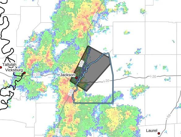
At 2:25 p.m. CDT Wednesday, Doppler radar was tracking a cluster of strong thunderstorms over Richland moving northeast at about 30 mph, an alert posted on Facebook said. The storms are impacting central Rankin, east central Hinds and southeastern Madison counties through 3:30 p.m. CDT.
The alert said the storms could produce wind gusts up to 50 mph and pea-size hail up to 0.25 inch. Radar indicated those hazards, and officials warned gusty winds could knock down tree limbs and blow around unsecured objects. Minor hail damage to vegetation is possible.
The storm was expected near Jackson, Pearl and Flowood around 2:30 p.m.; Ridgeland and Brandon around 2:35 p.m.; Madison around 2:40 p.m.; Fannin around 2:45 p.m.; Gluckstadt and Goshen Springs around 2:55 p.m.; and Canton and Pisgah around 3:00 p.m., the alert said.
Officials advised anyone outdoors to seek shelter inside a building. This is a developing situation; we will provide more information as it becomes available.