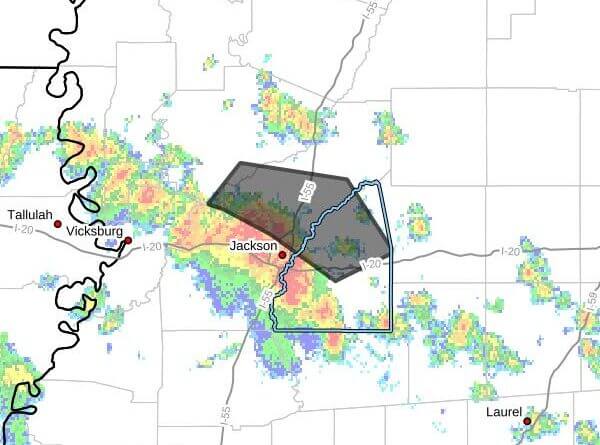
At 11:35 a.m. CDT Sunday, Doppler radar tracked a line of strong thunderstorms moving northeast at about 25 mph that will affect central Rankin, northeastern Hinds and southern Madison counties through 12:15 p.m. CDT, a weather advisory said.
Radar indicated wind gusts up to 40 mph and torrential rainfall with these storms. The advisory warned that gusty winds could knock down tree limbs and blow unsecured objects, and that heavy rain may cause localized flooding. The message advised people outdoors to seek shelter inside a building and warned against driving through flooded roadways.
Storms were expected near Jackson, Madison, Ridgeland, Brandon, Gluckstadt, Flora, Annandale and Pocahontas around 11:40 a.m.; Canton around 11:45 a.m.; Fannin around 11:50 a.m.; and Goshen Springs around noon, the advisory said. Those on or near Ross Barnett Reservoir were urged to get out of the water and move indoors or into a vehicle because boats could be damaged or overturned in high winds.
Maximum hail size reported was 0.00 inch and maximum wind gust 40 mph. The advisory reminded that lightning can strike as far as 10 miles from a thunderstorm and that hearing thunder means you are close enough to be struck. This is a developing story and will be updated as more details emerge.