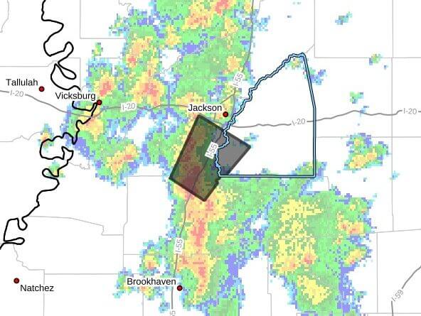
A weather statement at 2:02 p.m. CDT Wednesday said Doppler radar indicated a strong thunderstorm moving northeast at 25 mph was affecting southwestern Rankin, southeastern Hinds and north central Copiah counties and would persist through 2:45 p.m. CDT.
At 2:01 p.m. CDT, radar was tracking the storm over Terry, about seven miles southwest of Byram, the statement said. The advisory listed hazards of wind gusts up to 50 mph and pea-size hail, with a maximum reported hail size of 0.25 inch.
The storm was expected to be near Jackson, Byram, Terry and Whites around 2:05 p.m. CDT. The statement warned that gusty winds could knock down tree limbs, blow around unsecured objects and cause minor hail damage to vegetation.
Officials advised those outdoors to seek shelter inside a building. We will provide more information as it becomes available.