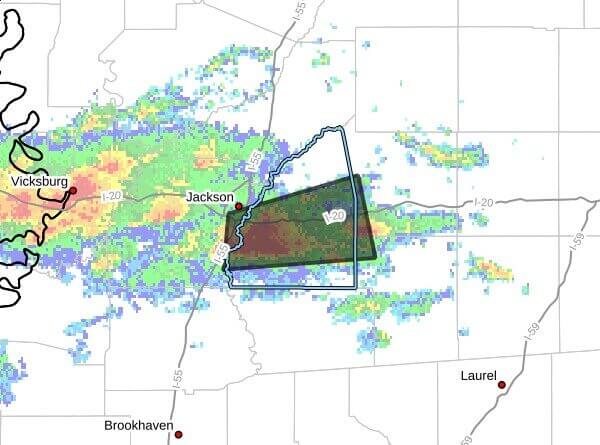
A weather statement posted on social media said at 12:37 p.m. CDT that Doppler radar was tracking a strong thunderstorm near Brandon moving east at 30 mph and would impact southern Rankin, northwestern Smith, southwestern Scott and southeastern Hinds counties through 1:30 p.m. CDT.
The storm is producing wind gusts up to 40 mph and pea-size hail, with a reported maximum hail size of 0.25 inch and maximum wind gusts of 40 mph. Radar indicated the gusty winds could knock down tree limbs and blow around unsecured objects, and minor hail damage to vegetation is possible.
The statement said the thunderstorm was expected near Jackson and Brandon around 12:45 p.m. CDT, Pelahatchie around 12:50 p.m. CDT and Polkville around 1:05 p.m. CDT. Frequent cloud-to-ground lightning is occurring with the storm and can strike as far as 10 miles from the thunderstorm.
Officials advised anyone outdoors to seek shelter inside a building or vehicle, exercise caution near older trees and secure loose outdoor objects. The statement said the storm may intensify and urged listeners to monitor local radio and television for additional information and possible warnings from the National Weather Service.
We will provide more information as it becomes available.