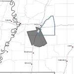
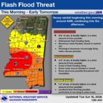
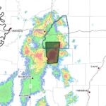
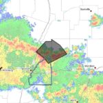
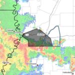
The National Weather Service in Jackson, Mississippi, issued a flash flood warning Thursday for eastern Hinds County, south central Madison County and western Rankin County until 3:45 p.m. CDT.
The NWS said at 1:42 p.m. CDT Doppler radar indicated thunderstorms producing heavy rain across the warned area. Between 1 and 2 inches of rain have fallen, and the expected rainfall rate is 2 to 3 inches in 1 hour.
Additional rainfall amounts of 2 to 3 inches are possible in the warned area, and the NWS said flash flooding is ongoing or expected to begin shortly.
Flash flooding can develop rapidly during intense rainfall and commonly affects low-lying areas and roadways. The National Weather Service routinely advises people to avoid driving through flooded streets because moving water can be deceptive and dangerous.
This is a developing story and will be updated as more details emerge.
Jon Ross Myers founded Mississippi News Group in 2013. Before founding the organization, he worked at The Daily Mississippian, The Marion Salute and The Southern Sentinel. A Mississippi journalist and writer based in Ripley, he received second place in poetry in the 2025 William Faulkner Literary Competition for "The Garden."
Stay connected
Mississippi, wherever you are.
Follow our coverage on Facebook and watch Mississippi News Group on YouTube.