Mississippi news: Gulf odds climb to 80% as Coast rain threat returns
Evening edition — Monday, October 5, 2026
The Gulf disturbance became a more immediate forecasting concern Monday evening as federal forecasters sharply increased its two-day development odds. Mississippi’s Coast also faces a renewed late-week rain outlook, while inland communities have a mostly dry Tuesday ahead. Tonight’s other developments include a Greenville burglary investigation newly covered by Mississippi News Group, national recognition for a Starkville school courtyard and an announced fundraiser supporting children with disabilities. The voter-registration deadline has reached its final hours for qualifying mailed applications.
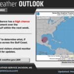
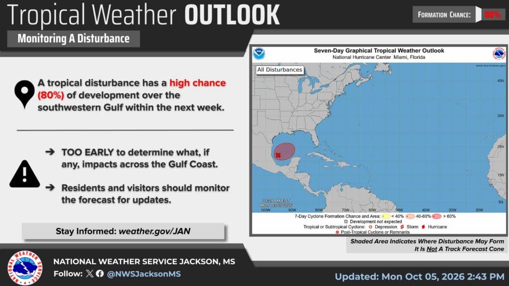
Gulf formation odds rise to 80%, with a much higher two-day chance
The National Hurricane Center’s 7 p.m. CDT Monday outlook gives disturbance AL92 in the southwestern Gulf an 80% chance of developing within seven days and a 70% chance within 48 hours. Both measures have increased since this morning’s briefing, which reported seven-day odds of 70% and two-day odds of 30%.
The larger change is in the shorter window: development has become more likely within the next two days. NHC says a trough is producing disorganized showers and thunderstorms, with conditions only marginally favorable but gradual organization increasingly likely. A tropical depression is expected during the middle of the week. Forecasters expect an initial drift toward the east-northeast before a northward turn.
That remains a formation outlook, not a Mississippi landfall probability or an established storm track. NHC says specific northern Gulf Coast impacts cannot yet be determined. People with coastal travel, outdoor work or boating plans should follow subsequent official forecasts as the disturbance organizes; a percentage alone does not establish where a system will go or how strong it will become.
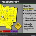
Coast forecast adds 3–6 inches of possible late-week rain
The New Orleans/Baton Rouge forecast discussion updated at 6:24 p.m. brings the next rain concern into clearer focus. Its Friday-through-Sunday-night outlook allows 3–6 inches along the Mississippi Gulf Coast and areas south of Louisiana’s coastal lakes, with the placement of the heaviest rain still subject to change.
This is a new late-week forecast, separate from the weekend rain and flood watch that expired early Monday. The outlook favors the greatest rain chances along and east of a Houma–New Orleans–Picayune line. In the shorter term, showers are expected mainly near the immediate coast and offshore through Wednesday, before rain chances begin increasing again Thursday.
The 1:47 p.m. marine message retains the Mississippi Sound small-craft advisory from 7 a.m. Tuesday, October 6, to 3 a.m. Friday, October 9. Northeast winds of 20–30 knots and seas of 6–9 feet are forecast across its listed waters. The afternoon expansion adds Louisiana waters farther west with a Wednesday start; it does not move Mississippi Sound’s Tuesday start. Check the specific marine zone before departing.
Tuesday stays mostly dry inland as northern fuels dry out
The 6:38 p.m. Jackson forecast lists Tuesday highs of 87 in Jackson, 86 in Meridian and Hattiesburg, 88 in Vicksburg and Natchez, 87 in Greenville and 89 in Greenwood. Tuesday rain chances are zero in those locations except Vicksburg, where the table now gives 10%, compared with this morning’s dry forecast.
Jackson forecasters expect less humid days, warm afternoons and cooler nights through much of the week, with tropical moisture potentially bringing rain back over the weekend. Tuesday-morning low clouds or reduced visibility are possible around Meridian and Hattiesburg before conditions improve by midmorning.
The 5:59 p.m. Memphis update keeps elevated fire danger in its workweek outlook. Its afternoon analysis described gusty winds and drying fine fuels in north Mississippi, then increasing concern later in the week as fuel moisture falls. That adds a fuel-drying concern to the low-humidity signal reported this morning. Check and follow local burn restrictions; the forecast itself does not establish a county burn ban.
Greenville police detail charges in September 30 burglary response
Mississippi News Group’s report published Monday covers a Greenville police statement about a September 30 response at a residence being renovated in the 1100 block of Burns Street. The incident occurred last Wednesday, rather than today.
According to the department’s original statement, officers responding around 8:51 a.m. arrested Joshua Bruins inside the residence and found Tabitha Knight in a bedroom closet. Police say they recovered suspected controlled substances associated with Knight and that she initially gave a different identity.
Police report house-burglary and trespassing charges against both. Knight also faces providing-false-information and controlled-substance-possession charges. The Criminal Investigation and Special Operations divisions are continuing the investigation. These are police allegations and charges, not court findings; both defendants are presumed innocent unless proven guilty. The statement does not supply a court date or disposition.
Sudduth Elementary courtyard earns national landscape-design honor
MSU’s October 5 announcement reports an American Society of Landscape Architects Honor Award for a team of approximately 60 students and faculty advisors who helped transform a courtyard at Sudduth Elementary in the Starkville Oktibbeha Consolidated School District.
The space supports outdoor meals and instruction, with talking tubes, an abstract forest, a stone abacus and a winding caterpillar bench. Schoolchildren contributed suggestions about shape, color and scale, while the university team worked with teachers and the parent-teacher organization.
The project began several years ago as an exercise in Associate Professor Peter Summerlin’s Construction Materials class. Monday’s news is the national recognition of that work, rather than a claim that the courtyard opened today. Graduates Rachel Bowers and Jake Lindley accepted the award with Summerlin at the society’s recent Los Angeles conference. Lindley is a Tupelo native. The project offers a concrete example of university design training producing a usable local learning space.
Newly announced Halloween fundraiser supports specialized education
A second MSU announcement released October 5 sets out plans for the T.K. Martin Center’s October 31 Trick or Trot fundraiser. Proceeds support the center’s special-needs preschool and elementary/middle school program.
On-site registration and children’s activities begin at 9 a.m.; the 1-mile campus loop starts at 10 a.m. Participants may run, walk or stroll, and organizers encourage child-friendly costumes. Entry costs $15 for individuals or $30 for families of up to five immediate family members. The official announcement links to online registration.
Community groups can also staff cheer stations with at least five people. Station registration is free, with donations welcomed. The center’s school program combines individualized instruction with eligible speech, occupational and physical therapy services. This is an education and community fundraiser, giving families and volunteers time to plan participation before Halloween.
Registration deadline passes local office closing time; absentee dates follow
The 5 p.m. in-person deadline described in Monday’s DeSoto County coverage has passed. The Secretary of State’s notice says mailed registration applications must be postmarked no later than today, October 5, to qualify for the November 3 general election. A Tuesday postmark does not meet that stated deadline.
For already registered voters, the state says in-person and mail-in absentee ballots are available through circuit clerks. Its calendar lists Saturday absentee voting beginning October 24 and an October 31 in-person absentee deadline. Check the state’s linked voter tools and your circuit clerk for registration status and applicable absentee procedures. This is a deadline update and next-step reminder, not an extension.
Featured graphic: NWS Jackson tropical outlook updated October 5, 2026, at 2:43 p.m., showing the 80% seven-day formation outlook. Credit: National Weather Service Jackson and National Hurricane Center. The shaded area indicates possible formation, not a forecast track. Unaltered federal NWS material is public domain.
Compiled with AI assistance from Mississippi News Group coverage and linked official sources. See our editorial standards.