Mississippi news: Gulf development odds jump as coastal advisory and fire danger emerge
Morning edition — Monday, October 5, 2026
Mississippi starts the workweek with a substantially higher chance of tropical development in the southwestern Gulf, a newly issued advisory for coastal boaters and drying weather that brings a different concern in the north: fire danger. The southern flood watch has expired. Away from the weather, a Meridian nursing scholarship and a Starkville research opportunity offer practical health and education news, while today is the statewide voter-registration deadline.
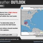
Gulf development odds rise to 70%; Mississippi impacts remain uncertain
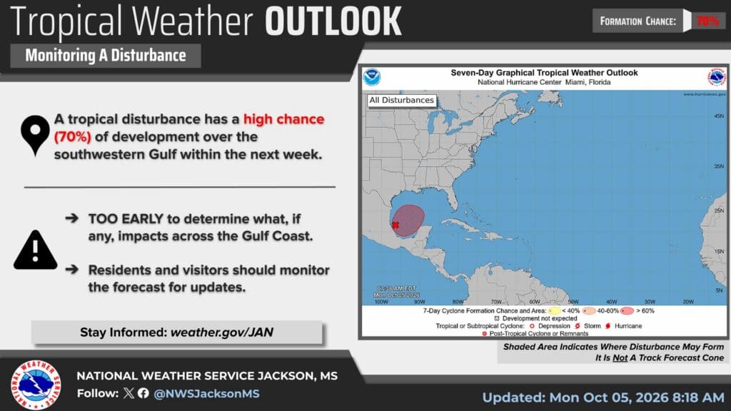
The National Hurricane Center’s 7 a.m. CDT Monday outlook raises the southwestern Gulf disturbance’s chance of tropical formation within seven days to 70%, up from 40% in Sunday evening’s briefing. Its 48-hour chance is now 30%, compared with near zero last night.
Forecasters describe disorganized showers and thunderstorms associated with a trough of low pressure. They say gradual organization has become more likely and a tropical depression is likely to form during the middle or latter part of the week. The disturbance is expected to drift east before turning north.
The percentages measure the chance of a tropical system forming, not the chance of a Mississippi landfall. There is no established track or local impact forecast in this outlook. The NWS Jackson graphic accompanying this edition likewise stresses that it is too early to determine Gulf Coast impacts. Residents and visitors should monitor later official updates before making late-week travel or boating decisions.
New small-craft advisory starts Tuesday in Mississippi Sound
A marine weather message issued at 2:43 a.m. Monday places Mississippi Sound and specified neighboring coastal waters under a small-craft advisory from 7 a.m. Tuesday, October 6, until 3 a.m. Friday, October 9. The covered waters also include Chandeleur and Breton sounds, Lake Borgne and open Gulf waters east of the Mississippi River’s mouth.
NWS expects northeast winds of 20–30 knots and seas of 6–9 feet in the advisory area. Conditions will be hazardous for small vessels; inexperienced mariners, especially in smaller boats, should avoid navigating in hazardous conditions.
This is a newly issued advisory with a Tuesday start, rather than a claim that its advisory period has already begun Monday. Check the forecast for your specific marine zone before departing. The product’s area-wide sea forecast should not be read as an identical wave height in every sheltered location.
Southern flood watch expires as rain diminishes
The 5:27 a.m. New Orleans/Baton Rouge forecast discussion confirms that the southern flood watch was allowed to expire at midnight after precipitation over land diminished. That changes the active-watch status reported Sunday; it does not establish that every flooded street or drainage problem has cleared.
The front is moving offshore, allowing drier air to spread south. Some showers and a few thunderstorms remain possible today, but forecasters expect a diminished heavy-rain threat and less rain than during the weekend.
NWS Jackson’s 6:53 a.m. update lists Monday rain chances of 30% in Meridian and Hattiesburg, 10% in Jackson and Natchez, and zero in Vicksburg, Greenville and Greenwood. Meridian’s daytime chance is higher than Sunday evening’s 20% forecast. Tuesday’s table is dry in all seven listed cities. These are location forecasts, not a statewide guarantee that no rain will fall.
North Mississippi’s fire-weather concern sharpens
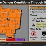
The 6:15 a.m. NWS Memphis update puts elevated fire danger among its principal workweek concerns. Its overnight analysis says some areas, especially north Mississippi, could see afternoon humidity below 25% or even 20%.
That is a sharper drying signal than the general 30–40% Monday–Tuesday humidity range discussed in Sunday evening’s edition. The fire-weather section still says light winds and recent wetting rains should restrain a higher threat, but it expects humidity to fall to 25% or lower as warmer weather returns from Wednesday.
Anyone considering outdoor burning should check local restrictions and conditions first. This forecast is not a county burn-ban order. Recent rain does not remove the need for caution as afternoon air dries and temperatures rise.
Meridian nursing graduates establish annual $1,000 scholarship
MSU-Meridian’s October 2 report, newly covered in these briefings, says graduates Jasmine Lindsey and Shay Naylor used personal savings to create The Lindsey & Naylor Future Nurses Scholarship. It provides $1,000 annually to one MSU-Meridian nursing student.
The two completed the Master of Science in Nursing program in August. Naylor, a Meridian resident working in the intensive care unit at Ochsner Rush Health, and Lindsey, a Hattiesburg resident, had themselves received scholarship assistance.
Their gift adds a recurring source of student support rather than a one-time award for an entire class. The university report does not give an application deadline or selection rules, so prospective students should obtain those details through the linked School of Nursing rather than assume eligibility.
Starkville study seeks adults with and without disabilities
A September 29 MSU research announcement, highlighted again in the university’s October 5 digest, seeks Mississippi residents ages 18–65 with mild to severe intellectual disabilities or without disabilities. Participants must be able to walk independently and on a treadmill.
The cardiovascular and fitness study involves a two-hour assessment at the Jim and Thomas Duff Center, 695 Bully Blvd., followed by seven days wearing a physical-activity monitor. Researchers assess measures including blood pressure, glucose, cholesterol, strength, flexibility and cardiorespiratory fitness.
Participants receive a free cardiovascular and fitness report. This is research recruitment, not an announcement of completed findings or a substitute for routine medical care. To ask about participation and registration, contact Guillermo Oviedo at gro16@msstate.edu or Kya Davis at kd1365@msstate.edu.
Magnolia Moves begins next Monday
MSU Extension’s statewide Magnolia Moves Activity Challenge runs October 12–November 22. Its September 8 announcement supplies the schedule and participation instructions; today’s university digest brings the approaching start back into focus.
The MoveSpring app converts a range of physical activities into miles and steps. Participants receive nutrition tips and other healthy-living resources, and Extension plans weekly prize drawings across five age categories.
Spring participants are automatically entered but need to sign in with their existing account. New participants should use organization code MSUEXT through the official registration page. Families, friends and coworkers can form teams. Questions go to magnoliamoves@ext.msstate.edu.
Today is the voter-registration deadline
Today, October 5, is the deadline to register for the November 3 general election, according to the Secretary of State’s September 28 notice. Applications may be submitted in person at a circuit clerk’s office or mailed with a postmark no later than today.
This is the deadline previously flagged in Sunday morning’s coverage, not a new extension. Confirm local clerk hours before visiting. The state notice links to Y’all Vote tools for downloading an application, checking registration status and updating registration information.
Featured graphic: NWS Jackson tropical weather outlook, updated October 5, 2026, at 8:18 a.m. Credit: National Weather Service Jackson and National Hurricane Center. The shaded region indicates possible formation, not a forecast track. Federal NWS material is public domain.
Compiled with AI assistance from Mississippi News Group coverage and linked official sources. See our editorial standards.