National Weather Service warns heavy rain, flooding in Mississippi Friday
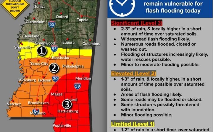
The National Weather Service warned Friday, June 19, 2026, that additional heavy rain will continue across Mississippi as the remnants of Tropical Storm Arthur slowly move eastward. The agency said as much as 3 inches of additional rainfall is possible, with locally higher amounts in some areas.
Many parts of the state already have experienced flash flooding, and forecasters said more rain is likely to cause further flooding that could affect roads and structures. The storms also may produce damaging wind gusts, mainly during the early afternoon to evening hours, the agency said.
The Mississippi Emergency Management Agency posted photos and the National Weather Service advisory on Facebook and urged residents to avoid already flooded areas and never drive around barricades. The post warned that roads may be flooded or closed, advised people to identify alternate routes and noted that river flooding is expected, adding the reminder, “Turn around, don’t drown!”
Remnants of tropical storms often produce intense rainfall over short periods, increasing the risk of flash and river flooding. Authorities will continue to monitor conditions and provide updates. This is a developing story and will be updated as more details emerge.


