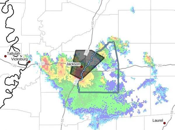
The National Weather Service in Jackson issued a severe thunderstorm warning Sunday, May 17, 2026, for parts of central Mississippi, saying a storm located near Jackson at 6:43 p.m. CDT was moving northeast at 15 mph. The warning was in effect until 8 p.m. CDT.
The bulletin said radar indicated 60 mph wind gusts and quarter-size hail. It also listed a radar-indicated maximum hail size of 1.00 inch. The NWS warned that hail could damage vehicles and that winds could damage roofs, siding and trees.
The storm was expected to affect Jackson, Pearl, Ridgeland and Flowood around 6:50 p.m. CDT and Madison around 7 p.m. CDT, the agency said.
The NWS urged residents to move to an interior room on the lowest floor of a building for protection. The agency issues severe thunderstorm warnings when storms produce winds of at least 58 mph or hail 1 inch in diameter or larger.
This is a developing story and will be updated as more details emerge.