Reeves urges residents to avoid flooded roads as Arthur brings heavy rain
Mississippi Gov. Tate Reeves wrote on Facebook that residents should remain weather aware as Post-Tropical Cyclone Arthur moves inland along the northeastern Texas coast and spreads heavy rain into the Southeast. He wrote that Arthur rapidly became disorganized and that all Tropical Storm Warnings have been canceled.
Reeves said the remnants of Arthur are expected to produce rainfall totals of 5 to 10 inches, with isolated higher storm totals near 20 inches through early Friday across portions of Louisiana, Mississippi, Alabama, Georgia and the Florida Panhandle.
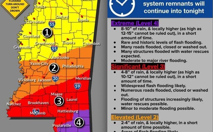
He warned that Gulfport and Poplarville could see 8 to 10 inches of rain, with locally higher amounts possible in a short time. Reeves said many roads could be flooded, closed or washed out, many structures could flood and water rescues are expected. He added that moderate to major river flooding is possible.
Reeves cited additional localized forecasts, saying McComb, Hattiesburg, Laurel, Meridian, Magee and Brookhaven could see 4 to 8 inches of rain, with totals as high as 10 to 12 inches possible. He said Yazoo, Vicksburg, Jackson, Philadelphia, Natchez and Kosciusko could receive 2 to 4 inches, with flash flooding likely.
Reeves wrote that the most significant rainfall is expected to accumulate between 12 a.m. Thursday and late tonight and urged residents: “Turn around, don’t drown. Stay safe, Mississippi!” This is a developing story and will be updated as more details emerge.


