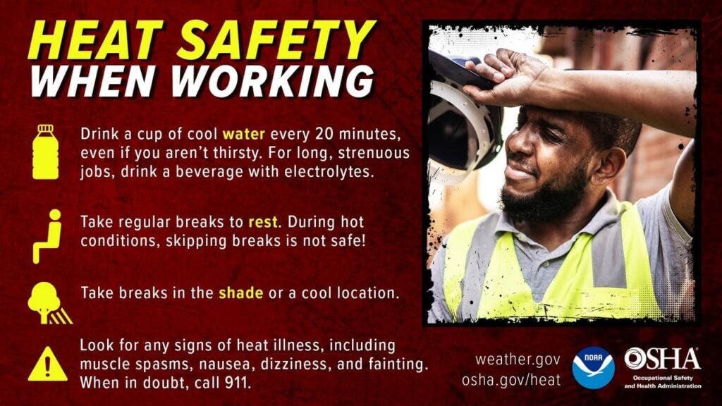
Dangerous heat will continue through the rest of this week
Dangerous heat will continue through the rest of this week, with daily high temperatures in the upper 90s.
Read MoreIndependent Mississippi news Since 2013
Mississippi news, sports and community coverage.
Dangerous heat will continue through the rest of this week, with daily high temperatures in the upper 90s.
Read More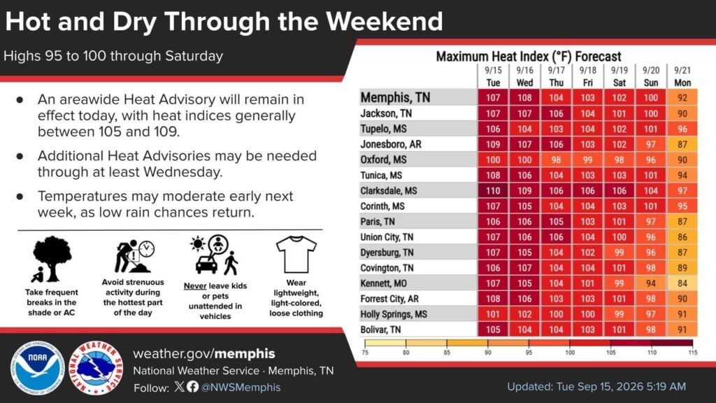
Afternoon heat indices are expected to remain well above 100 for several days, with a chance of moderation early next week.{
Read More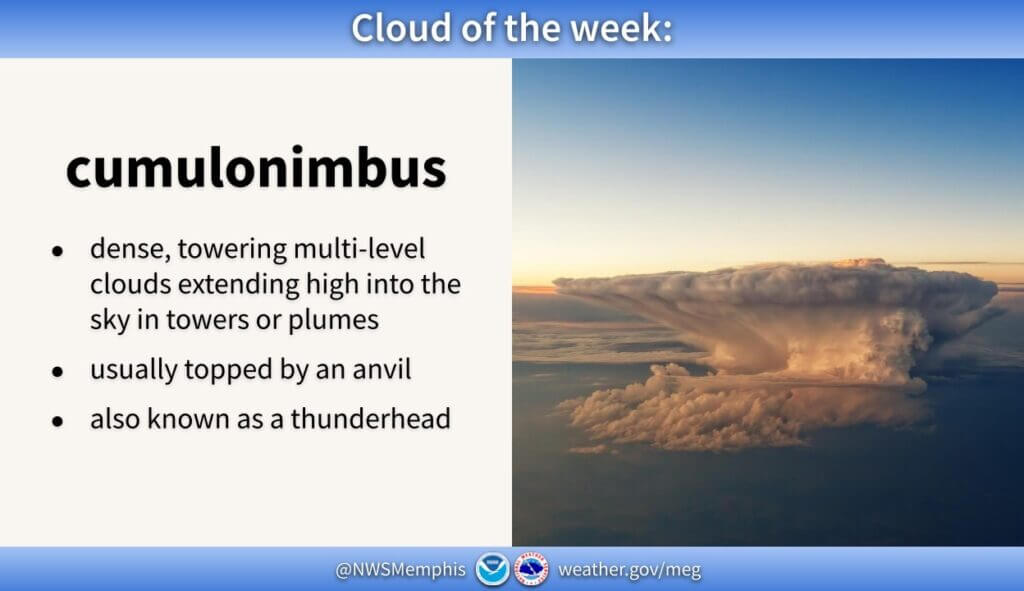
The National Weather Service office in Memphis highlighted the cumulonimbus and invited people to submit photos of the towering cloud type.
Read More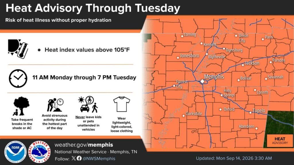
A Heat Advisory remains in effect through at least Tuesday as heat index values reach 105 to 109 degrees and highs approach 100 degrees.
Read More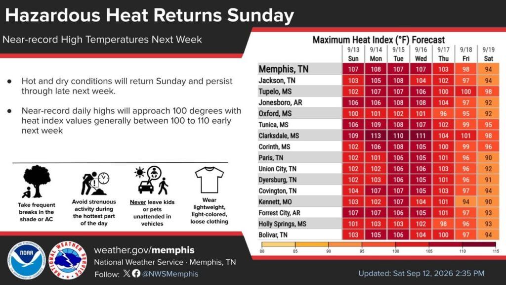
Hot, humid weather with upper-90s highs is expected through much of next week, while heat index values may reach 105 to 110 degrees.
Read More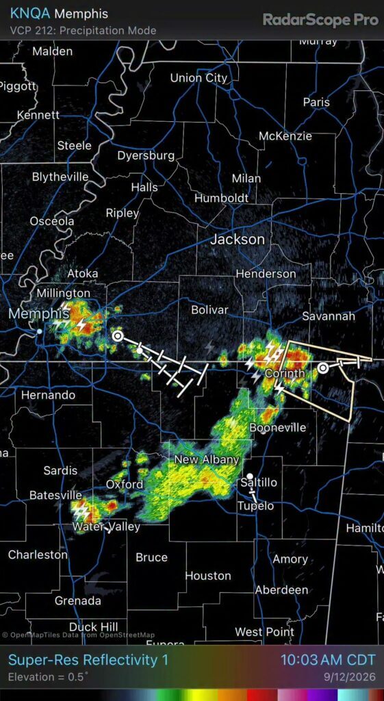
Strong storms moving across the area this morning could bring heavy rain, lightning and wind gusts of 30 to 50 mph.
Read More
Rainfall estimates from roughly the past 24 hours varied widely, with some areas receiving several inches and others none at all.
Read More
Thunderstorms are expected to become more widespread, with a low chance of strong to severe storms and damaging winds as the main threat.
Read More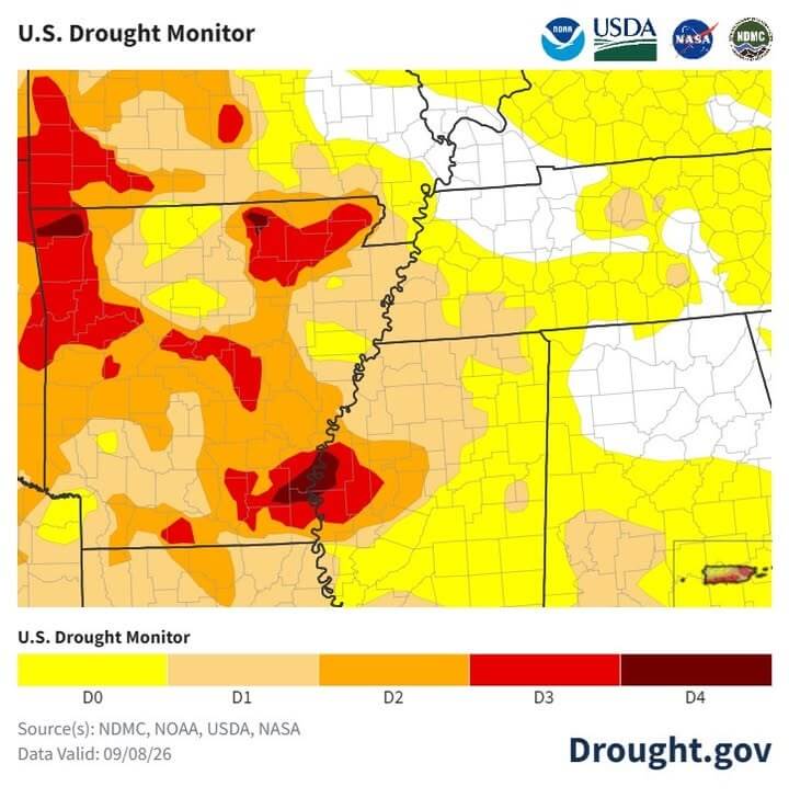
The updated Drought Monitor shows hot, dry conditions over the past 30 days, while models point to cooler, near-normal temperatures late next week.
Read More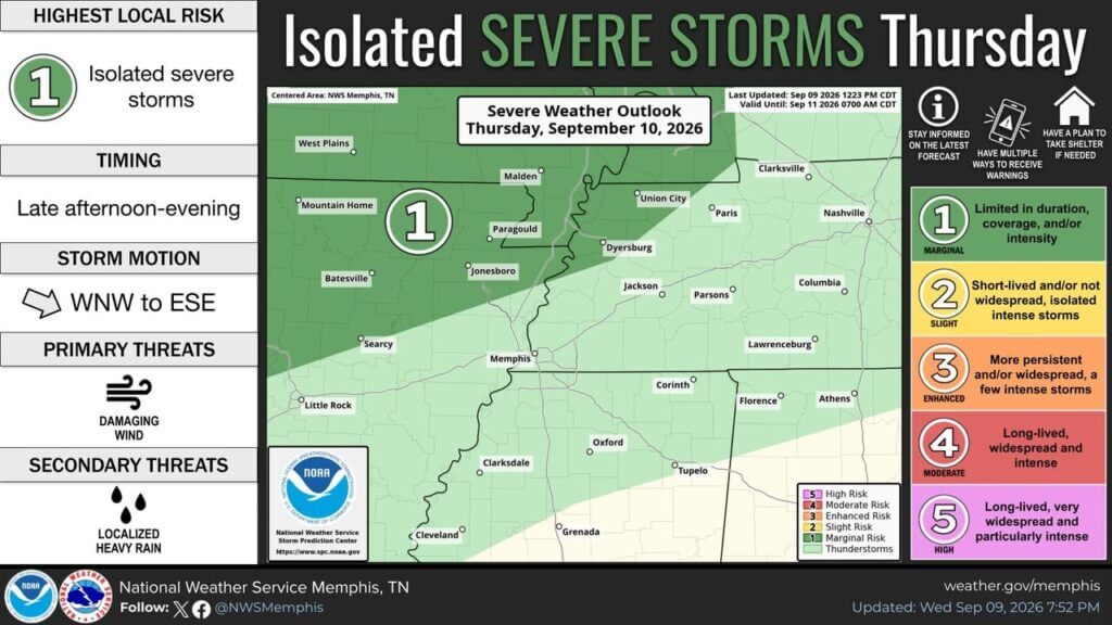
A Marginal Risk for severe storms is in place Thursday for portions of the Mid-South, with damaging winds the primary concern.
Read MoreStay connected
Follow our coverage on Facebook and watch Mississippi News Group on YouTube.