Extreme cold warning begins 11 p.m.; cold advisory follows
An extreme cold warning takes effect at 11 p.m. CST Friday and remains in place until 6 p.m. CST Saturday, followed by a cold weather advisory from 6 p.m. Saturday to noon CST Sunday, a Facebook post from local weather officials said.
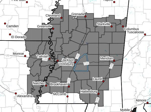
The advisory and warning cover portions of southeast Arkansas, northeast Louisiana and central, east central, north central, northeast, northwest, south central, southeast, southwest and west central Mississippi. Dangerous wind chills as low as 0 degrees are expected during the warning, with subfreezing wind chills as low as 2 degrees below zero possible, the post said. During the advisory, wind chills could be as low as 5 degrees above zero. Forecast lows are around 15 degrees Friday night and between 10 and 15 degrees Saturday night.
Officials warned that prolonged freezing temperatures could rupture water pipes and that very cold wind chills raise the risk of frostbite and hypothermia, especially for those with prolonged exposure. Strong gusty winds of 30 to 40 mph could produce even lower wind chills and complicate ongoing power restoration in areas still dealing with ice and storm damage.
Precautions include dressing in layers with hat, face mask and gloves; wrapping, draining or allowing pipes to drip; draining in-ground sprinkler systems; keeping pets and vulnerable people sheltered; and using portable heaters and generators safely. We will provide more information as it becomes available.


