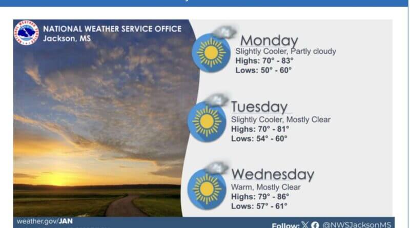
Above-normal warmth will continue across the local area early this week, though a brief cooldown is expected Monday and Tuesday as a dry cold front moves through, forecasters say. Temperatures are forecast to remain mostly above normal despite the front’s passage.
A dry cold front typically pushes cooler, drier air into a region without producing much precipitation. That pattern can lower humidity and bring clearer skies even as daytime temperatures remain mild compared with seasonal averages.
The continuing warmth, following several days of mild conditions, can affect outdoor plans, heating demand and the timing of spring agricultural activities. Residents planning outdoor work or events should expect mostly mild weather but be prepared for slightly cooler mornings and evenings behind the front.
Meteorologists use a combination of surface observations and computer models to track fronts and temperature departures from normal. Above-normal warmth refers to temperatures warmer than the long-term average for this time of year.
We will provide more information as it becomes available.