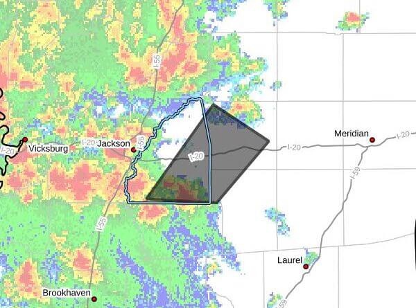
The National Weather Service in Jackson issued a severe thunderstorm warning Saturday, March 7, 2026, for parts of central Mississippi, saying a storm capable of 60 mph wind gusts and large hail was moving northeast. The warning was issued at 3:56 p.m. CST and remains in effect until 5:00 p.m. CST, the agency said.
The warning covers southeastern Rankin, northwestern Smith and southern Scott counties. At 3:56 p.m. CST, the storm was located over Johns, about 10 miles north of Mendenhall, moving northeast at 35 mph, the NWS said. Radar indicated maximum wind gusts near 60 mph and maximum hail size of 1.25 inches; the bulletin also described the hail as about half-dollar size.
The NWS warned of expected hail damage to vehicles and possible wind damage to roofs, siding and trees. The storm was forecast to be near Polkville, Puckett and Johns around 4:00 p.m. CST; Pelahatchie around 4:10 p.m.; Morton and Pulaski around 4:15 p.m.; Forest around 4:30 p.m.; and Forkville around 4:35 p.m., according to the warning.
Forecasters urged residents to move to an interior room on the lowest floor of a building for protection. The National Weather Service issues warnings when storms pose an immediate threat to life or property. This is a developing story and will be updated as more details emerge.