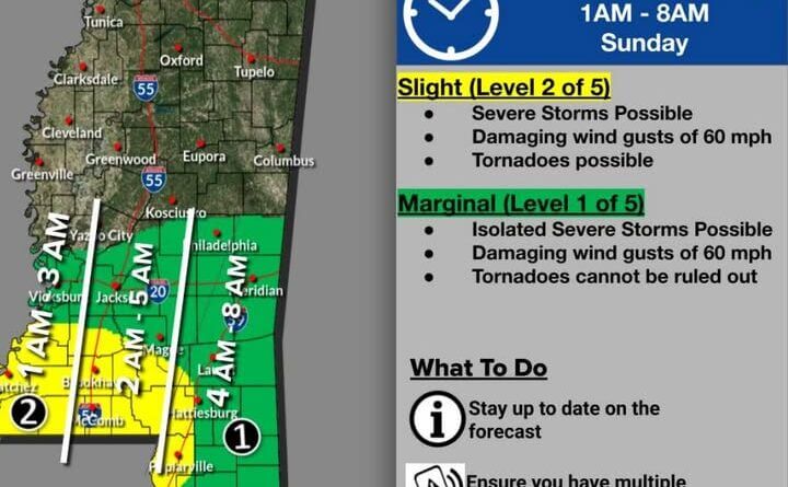
The National Weather Service is forecasting a slight risk of severe weather in central and south Mississippi beginning in the early morning hours of Sunday, Feb. 15, 2026, the agency said in a Facebook post.
Forecasters said severe storms, damaging wind gusts and tornadoes are all possible during the threat window and urged residents to stay weather aware.
“Slight risk” is one level on the National Weather Service’s severe-weather outlook scale and indicates conditions that could support organized severe storms, including isolated but potentially dangerous tornadoes and damaging winds. The designation signals a greater-than-routine chance of severe weather but is below higher threat categories that reflect more widespread or intense events.
The National Weather Service is the federal agency responsible for issuing forecasts, watches and warnings. Officials recommend that residents have multiple ways to receive alerts, identify safe shelter, secure outdoor objects and be prepared to take action quickly if warnings are issued.
We will provide more information as it becomes available.