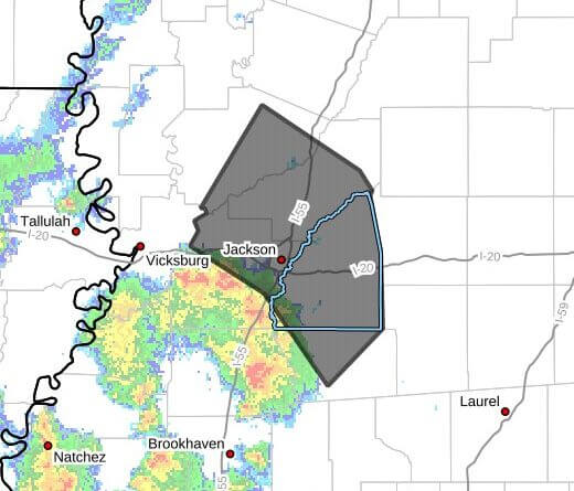
Strong thunderstorms will impact Hinds, Yazoo, Rankin, Madison and Simpson counties through 5:00 p.m. CDT Thursday, according to a weather bulletin. Doppler radar was tracking a line of storms at 4:04 p.m. CDT extending from near Youngton to near Byram to near Pinola, moving northeast at 30 mph, the bulletin said.
The storms are expected to produce wind gusts up to 50 mph and pea-size hail, with a maximum hail size noted at about 0.25 inch. The advisory said gusty winds could knock down tree limbs, blow around unsecured objects and cause minor hail damage to vegetation.
Forecasters listed estimated times of arrival for portions of the line: around 4:10 p.m. for Jackson, Clinton, Richland and Florence; 4:15 p.m. for Pearl and Mendenhall; 4:20 p.m. for Flowood, Cato and Pocahontas; and continuing through the area with towns such as Ridgeland, Brandon, Madison, Canton and others expected between 4:25 p.m. and 4:45 p.m., the bulletin said.
Officials advised anyone outdoors to seek shelter inside a building. Strong thunderstorms can produce downed trees, power outages and hazardous travel; motorists and residents should secure loose outdoor items and avoid flooded roadways. We will provide more information as it becomes available.